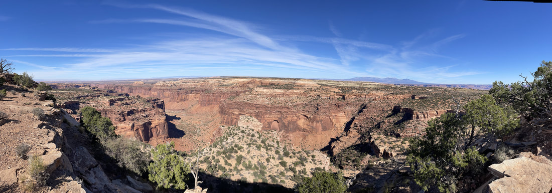
 At 337,598 acres of land, Canyonlands covers a lot of ground, yet the majority of visitors only get to see one of four districts of the park. Most popular is Island in the Sky, the northernmost section and most easily accessible from the recreation hub of Moab, Utah. We stayed at the Spanish Trail RV Park for six nights exploring the Moab area, and Island in the Sky was about 45 minutes from our campground. The Green and Colorado Rivers (considered a district in itself) separate the three other districts, and there are no connecting roads, so a visit to The Needles or The Maze will take a 2-6 hour drive from Moab. If it weren't for our GyPSy Guide*, we never would have noticed why the section is called Island in the Sky. Just after the Visitor Center is a segment of road called The Neck. This portion is just a few feet wider than the road (40 feet to be exact), and is the only connection of the mainland to the plateau that makes up this area of Canyonlands. In fact, early homesteaders used this grassy plateau to feed cattle, using the surrounding canyons as natural barriers to contain any wayward bovine. Early settlers reported the grass was "up to a horse's belly," but by 1964 when the plateau became a national park, the grass was nearly gone, having been over-consumed for decades. Very slowly, the native grasses are returning to their natural state, but this process takes much longer in the desert than it does back east! Currently the sparse patches of grass are about knee length. (Thank you GyPSy for that tidbit of history!) We spent the day stopping at viewpoints and doing short hikes at Mesa Arch, Aztec Butte, and Whale Rock (the kids' favorite.) The views were out of this world! Before heading back to town, Dusty decided that he just NEEDED to drive Shafer Trail (because some drunk guy at the campground told him it was the best road ever!) In the days of cattle ranching, crazy white men who needed to conquer the canyon made a one-cow-wide trail that zig-zagged down the side of a cliff into the depths. These days it's a little wider than one vehicle, but still a dirt road that could use some maintenance. And even today, crazy white men need to conquer it. I was ok until we started on the switchbacks descending 1500 feet into the canyon, at which point I was certain we were going to die. Absolutely terrifying. This "road" might be ok in a Jeep made for the backroads, but a Ford F350 with tires aired up to 80 PSI was not made for bouncy gravel roads and hairpin turns on the edge of a cliff. Thankfully, Dusty gave up on his dream (likely because he got tired of listening to his wife and daughter shrieking in fear) and found a tight turn to maneuver back around and up the mountain. So. Scary. Canyonlands Island in the Sky was beautiful...definitely worth a stop if you're in the area. The other sections of the park are more primitive in nature and great for high clearance four-wheel vehicles, backcountry backpacking, and mountain biking, and I'm sure they'd be worth a visit as long as you're prepared for your time there. Whether you're into some serious outdoor adventuring or just a beautiful scenic drive, Canyonlands has something to fit everyone. **Correction: Shafer Trail was not formed by crazy white men. Originally, it was a Native American trail used to access resources on the mesa top. Later it became a trail for sheep herders moving their flocks. In the 1950's it was widened to fit trucks that were used to move uranium out of the canyon. It was named after John Shafer, who used the trail to move his cattle. But, even so, crazy white men still feel the need to conquer it. Case in point: 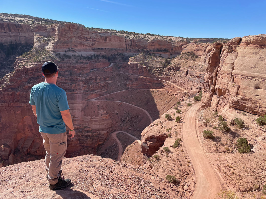 Dustin dreaming of conquering Shafer Trail *Contains affiliate link
0 Comments
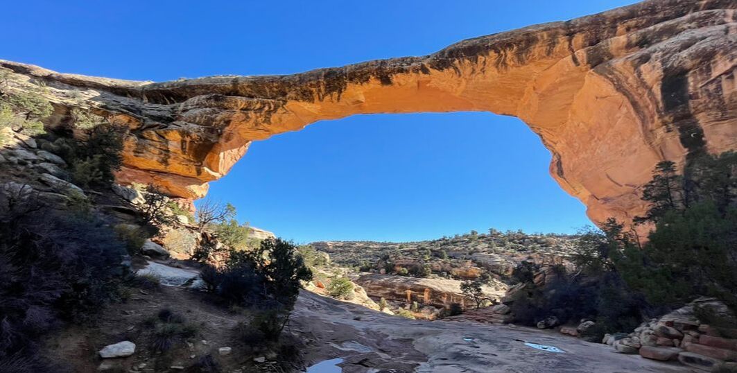 On our drive from Flagstaff to Moab, we stopped at Monument Valley, which spreads across the Navajo Reservation in northeast Arizona into southeast Utah. Ten minutes after rolling in to our KOA and unhooking the rig, we were ready to hit the road for some more exploring. On the way out of the campground, we ran into some friends from Maryland who were just getting checked in! Our one night in Monument Valley was shaping up to be a fun one! Monument Valley Navajo Tribal Park Monument Valley Navajo Tribal Park is completely run by the Navajo Nation. There is a charge of $8 per person for entry. The park has a hotel, restaurant, and large gift shop with native crafts and souvenirs. Upon entry, it's clear that the park doesn't have the conveniences of national parks, but I respect that the Navajo do things their own way. They welcome outsiders to this spectacular piece of land, but expect that rules be respected and followed. Since the Navajo Nation was hit particularly hard with COVID, one of these rules includes wearing a mask both indoors and outdoors while on the reservation. Tribal members offer guided tours by Jeep, which would be very beneficial. Since we blew our budget already this month, we elected to do the self-guided driving tour on the 17 mile dirt road loop. The problem with the self-guided tour was that we didn't have a map. The visitor center had run out of them and suggested you take a picture of their map. Numbers on the map suggested there were viewpoints, but there wasn't a key to name or explain any of the viewpoints. Lack of explanations left my knowledge cup feeling a little dry, but after I got over it and started to just enjoy the scenery, the drive was absolutely beautiful with rock formations and vegetation that can only be found in Monument Valley. If we did it all over again, we probably would have opted for the tour so we could learn more about what this land means to the Navajo people.  After returning back to the RV, we spent the evening sitting by the campfire catching up with friends. Banana got her canine fix, playing with their two dogs, while Brickhead had us on the edge of our seats with a horror story he's been working on the last week. It was nice to have a bit of familiarity while out in the middle of nowhere in strange lands! The next day we took off for Natural Bridges, but not before making a quick trip to Forest Gump Hill. Here, the Navajo had to put in a speed limit reduction, flashing lights and pedestrian crossing signs on the main highway to protect all the crazy tourists who stand in the middle of the road for the iconic photograph of where Tom Hanks, posing as Forrest Gump, stops in the middle of the road and says, "I'm pretty tired. I think I'll go home now." The multiple pull-offs can be filled with vehicles all hours of the day. There are two ways you can travel to Natural Bridges from Monument Valley. Rt. 261 is a dirt road with a 10,000 lb weight limit. If you're pulling a trailer, you need to take 191 to 95 through Bears Ears National Monument. Thankfully we saw the signs before any major mishaps! We dropped our trailer at the Blanding Visitor Center and just took the truck the 35 miles to the monument. Bears Ears National Monument deserves a shout out while we're at it. According to Wiki, this national monument was made official by President Obama in 2016, but President Trump reduced the 1 million+ acres by some 200,000+ in 2017, later to be returned to government property by President Biden in 2021. The land is co-managed by the Forest Service, the Bureau of Land Management, and a coalition of five Native tribes. The park boasts some 100,000 archeological sites, some of which are 3,500 years old. Aside from driving through, we didn't get to do any exploring. I don't believe it's a very established park at this time (likely due to political drama), so visitors would likely have to plan accordingly. We'd be interested in coming back another time, with a tour guide if possible. Natural Bridges National MonumentNatural Bridges became Utah's first national monument back in 1908. These bridges were formed by water cutting through rock, which is different from the arches formed at Arches National Park, which have been eroded away by wind over time. Our visit there is best told in pictures, but I will note a few details: The Visitor Center is closed on Tuesdays and Wednesdays in winter. Winter hours begin November 1 according to their website, but due to staffing shortages, winter came early. They were closed on October 18 when we arrived. We're finding this to be a common trend as we travel. The scenic drive is a nine mile, one-way loop with several short hikes and one long loop hike connecting all the bridges. The hike to Horse Collar Rim led to a 700 year old Puebloan cliff dwelling. You could hardly see the structures from the lookout point. How people lived there is a wonder in itself! 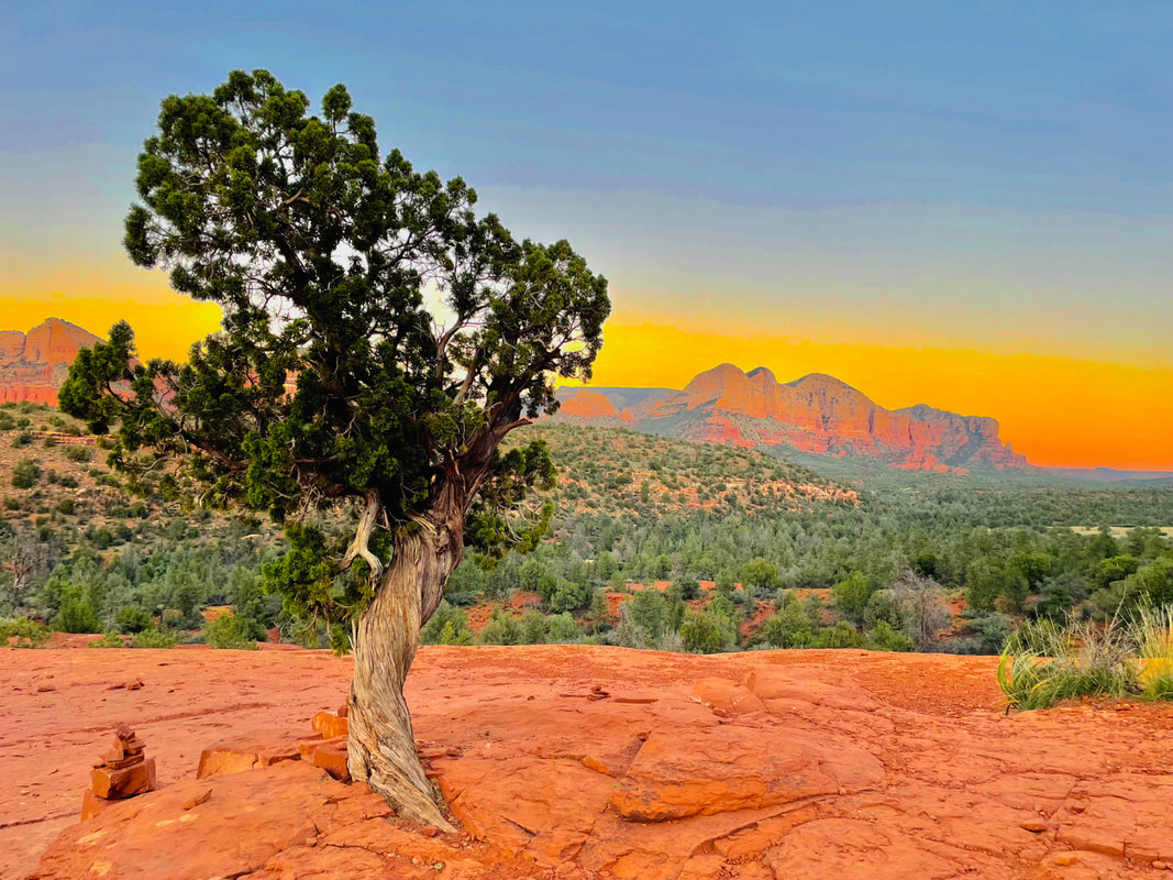 The Red Rocks of Sedona. Edited by RJ Ramsey The Red Rocks of Sedona. Edited by RJ Ramsey I'm just going to start off by saying this area was not what I expected. I anticipated small tourists towns with beautiful views and peaceful hiking trails. I'm sure at some point in recent decades, that's exactly what it was. However, Flagstaff is now a sprawling metropolis. Sedona is such a hot destination that open parking spaces are few and far between, whether you're looking for a restaurant or a trail head. Jerome is advertised to be a ghost town, but I can assure you that while this once sleepy little town may have ghosts, it's streets are now very much alive and booming with enough restaurants, shops, and art galleries to keep visitors content for hours. Despite all the people (of which I am one--that point is not lost upon me), the area still has its charm. The popular hiking trails are no joke--a few of them really kicked my butt--but the red rock formations and views were well worth it. In the Coconino National Forest alone there are over 100 archeological treasures of ancient native tribes, compelling evidence that ancestral connections run deep. Navajo operated stands line appropriate parking lots sharing handmade jewelry, rugs, and traditional crafts with visitors. With something for everyone, it's easy to see why people flock to this area. We stayed at Ft. Tuthill Recreation Area, affiliated with Luke AFB, for five nights. The price was cheap, being a military family camp, but the stay was kind of rough. The roadways were tight for bigger rigs and the sites were super uneven, so much so that our rig rolled back 6 inches into a tree as we got parked and we broke a light. The campground is right next to the Pepsi Amphitheater, so we listened to the thumping bass of midweek concerts by GWAR and Jelly Roll at bedtime. Fortunately, we were able to get our new Enduro lithium battery delivered, since our battery died, and Flagstaff had everything Dusty needed to get it installed. Now we should be able to boondock for two nights without having to worry about dragging out the generator or connecting the truck power to recharge the battery before we hook up. We're excited to try it out! We filled our days with lots of fun, including hours and hours of driving to different sites and quite a few activities skipped because parking wasn't available. We did several short hikes with big rewards. Sedona's VortexesSedona boasts four vortexes, or places where sensitive people tend to feel energy. I can't say that we were recipients of any tingling feelings, but we hiked three of them and, if nothing else, I did get short of breath! Aptly named, Bell Rock is shaped just as its name suggests. It was advertised as a one mile rock scramble, which sounded like a perfect fit for our family! It was much more of a challenge than I anticipated! Dusty and the kids made it up a steep sandstone slide, but with no hand holds or foot holds, I had to find another way up. During our time there, two different couples soaked up the rock's warm energy during their wedding ceremonies and a gymnast was there doing tricks with hula hoops. 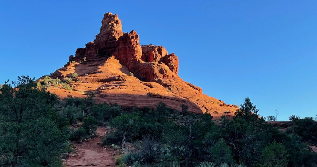 We arrived at Cathedral Rock at sunset. Dusty and the kids made it to the top as darkness set in. Thankfully they were prepared with flashlights. It's probably safe to say that most of the hike was a rock scramble. Coming back down in the dark was an adventure! Our GyPSy Guide* told us that Boynton Canyon was not only one of the most popular trails in Sedona, but it's also where visitors can find the Subway, a popular hiker attraction with rewards of beautiful views, an ancient cliff dwelling and native pictographs (paintings). The problem was, we couldn't find The Subway on any maps. Fortunately, we ran into a Friends of the Forest volunteer who pointed us in the right direction. After speaking with him, though, we learned more about the problems Coconino National Forest is having with this hike. As it turns out, unofficially, the Forest Service doesn't want people on that trail. But, in his words, "it's on the internet, so everyone wants to come and we just can't keep people out." And he's right: Likely 95% of the people we passed were either coming from or going to that location. With over 100 archeological sites in Coconino, there just aren't enough employees and volunteers to keep these areas safe. Not long ago, they found someone trying to remove the ancient pictographs because they thought it was graffiti. I mean...if people aren't adding to it, they're taking it away. SMH Currently though, without any signs asking people not to hike to The Subway, it seems the Forest Service is neither encouraging or discouraging adventurers to make the trek. So, we followed the crowds down the sunny, 3 mile, sandy trail. Along the way--get this-- we ran into a boy from Boy Scout Troop 429 (Dusty and Brickhead's troop in Calvert County, Maryland)! Talk about a small world! When we arrived at the cliff, we climbed up a rock slide (really...a slide made out of sandstone) into what looked like a keyhole carved between two cliff walls. From the keyhole, we had beautiful views. Adventurous climbers could carefully maneuver around a short drop off to a ledge that went around to the ancient cliff dwelling (which likely dated back between 500-900 years) and pictographs. I sat that one out, staying back to enjoy the views, but Dusty and the kids went around. Remnants of the PastThroughout the area are numerous signs of ancient tribes. Most remarkable are the cliff dwellings. The Sinagua people began building their homes in naturally occurring cliffs around 1050 AD. These wood, stone, and mortar homes were small villages in themselves (similar to apartment buildings), complete with common areas for social gatherings and storage rooms for shared food and supplies. The largest pueblo in the area contains 100 rooms. Many people wonder why these ancient tribes would have built communities in such precarious locations, and there are several theories that make sense. Some buildings, such as Montezuma Castle, face south, making it warm in the winter and cool in the summer. Of course using the structure of the cave as part of the building used less resources, which were scarce in the harsh desert environment. The high placement also protected them from flooding or approaching outsiders. We were able to see several of these cliff dwellings in the Verde Valley area, including Tuzigoot, Montezuma Castle, and Montezuma Well. These three were just the tip of the iceberg though. The southwest is dotted with hundreds of these archeological structures. So much to do, so little timeThe amount of things to do in the area was overwhelming...as was the amount of people. We enjoyed other activities like sliding down the waterfalls at Slide Rock State Park (so cool--and cold!), climbing through an old lava tube at Lava Cave Trail (which was packed with people), and moseying around the streets of Jerome, an old copper mine that literally lost part of its town when an excess amount of dynamite was discharged, causing a major landslide. There is certainly something for everyone in the area, and whatever your pleasure, you're likely to find enough of it to keep you entertained for weeks. Just keep in mind that there is plenty to keep thousands of other people entertained as well. And you'll find them...tens of thousands of people...all doing the same things you are. So be prepared to practice the art of patience. *Contains affiliate links 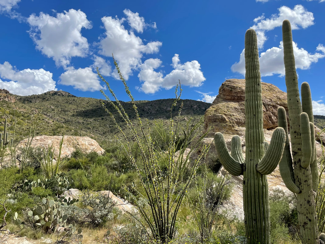 Sometimes life is about taking advantage of unexpected changes in plans. We knew that sometime this month, Dusty would be flying to Georgia for a job interview, but we just didn't know when. Last week we got notification that his possible future employer wanted him there in five days. Five days put us in Flagstaff, Arizona, so that meant he would have to fly out of Phoenix. Fortunately we were able to shift some dates around with other campgrounds so we didn't lose any time sightseeing in Flagstaff. Then there was the question about what to do with his flight schedule. The two hour drive to Phoenix meant that it was best to stay a night in a hotel so we could get him to the airport in time the next morning. But spending 8 hours traveling the same roads to drop him off and pick him up didn't sound too enticing. We decided that if we could just travel two more hours south to Tucson, the kids and I could mark one more National Park off our list. Onward: To Saguaro National Park!
There are two sections of Saguaro National Park, an east and west, with the city of Tucson sprawled out all around. It was actually kind of bizarre to be in a scenic national park surrounded by city. We arrived to the eastern Rincon Visitors Center just ten minutes before the two hour guided ranger tour around the 8 mile loop road began. We caravanned around to a few major stops and listened while the Ranger discussed the park and the importance of maintaining balance in the ecosystem. We learned:
I'm in enamoured by the flora of the Sonoran Desert. The saguaros are cool, no doubt about it, but I'm also impressed by the Palo Verde tree, which has adapted to have green limbs (with chlorophyll) so it can photosynthesize with its bark. Similarly, the Ocatillo is a succulent with multiple long, straight stems that reach ten feet in the sky. It grows leaves approximately three times a year (after monsoon rains), then drops them during dry periods to conserve energy, while it's green stems help produce food from sunlight. In the spring, the ocotillo grow flame orange blossoms on their tips, giving them the name "candlewood." We hadn't planned on coming this far south, but seeing the Saguaros was a fun surprise that came with the change in plans. The kids and I will be spending two nights at the Embassy Suites in Tucson while we wait to pick up Daddy. We're very thankful for Hilton Honors points, made to order breakfasts, high pressure showers, and a little more room to spread out in. I have to say though, after two nights gone, I'm already missing our little RV home. We're looking forward to getting back to adventures in Flagstaff and surrounds. Toss us your recommendations if you have any suggestions for things to do!
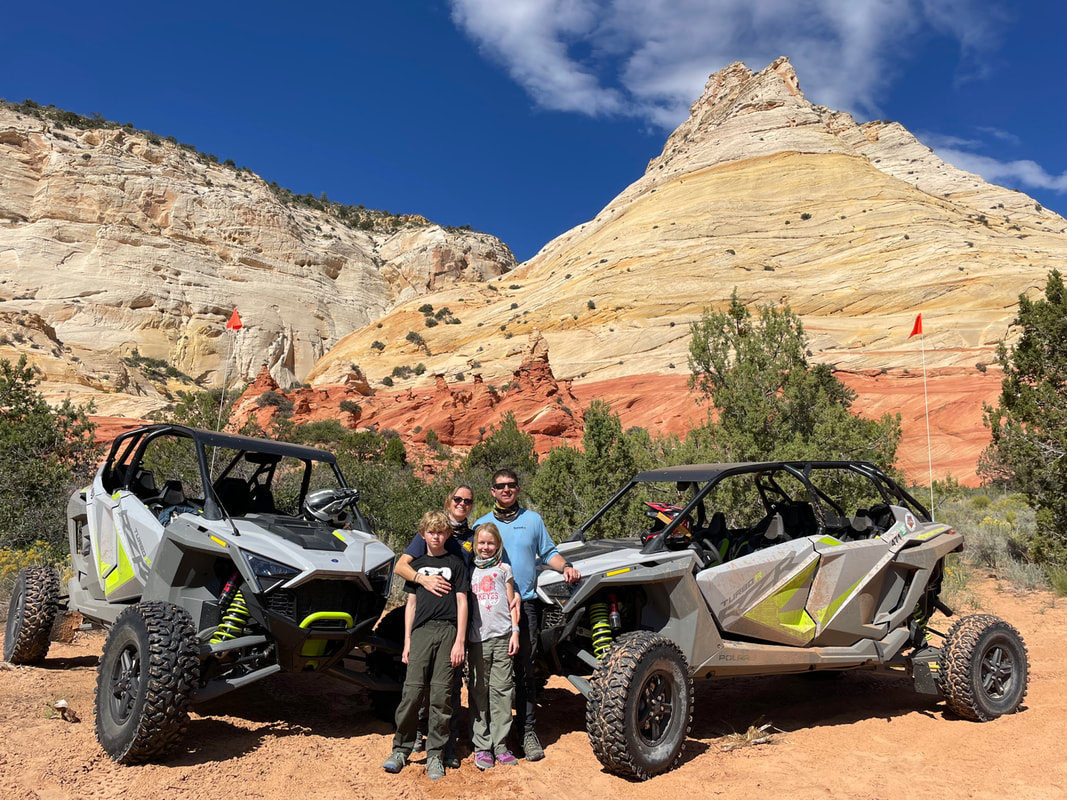 Kane County, Utah is bursting with so many treasures that tourists need a local to show them the ropes. The visitor center is a great place to start, but we were fortunate to stumble upon Kanab Tour Company, who offers UTV, hiking, and canyoneering tours. Their specialty is personalizing tours to the interests and abilities of their clients. We decided to do an 8 hour personalized UTV tour, which seemed pretty spendy at first, but it was a great gift for a deserving husband! After the tour though, we decided it was clearly well worth every penny. We started our tour at 8:15 a.m. with Dan, who has been a guide for three years. We received all the gear we needed for two adults and two children, and brought lunches, backpacks, sunscreen, and water. (The tour company provided a cooler full of water for cold refills.) Dan was great about checking in with us at the beginning to find out what interests we had and if there were any specific sites we had in mind. He tailored a tour that gave all our family members what they wanted. 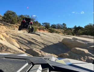 Our first destination was Hog Canyon, a UTVers paradise of technical rock climbs, steep inclines, deep sand, and narrow passages. I held on to the "oh shit bar" for dear life while Dusty expertly handled the trail like he operated the Polaris RZR Turbo-R every day. Next we headed out to the Mansard Petroglyph site. These petroglyphs are guessed to be 870-1,070 years old. The carved depictions on this sloped rock floor were pretty interesting, and archeologists aren't really sure what they mean. Can you figure them out? The Great Chamber is a huge sandstone alcove (and Instagram sensation.) Funny story on this: Locals call this site Cutler's Cove. A short while back the company started getting calls from potential customers asking for tours of the "Great Chamber." The tour company had no idea what they were talking about until they found out someone posted a photo on Instagram under the wrong name. The Great Chamber stuck, so now the Visitors Centers have started calling it by that name. Good ol' social media. 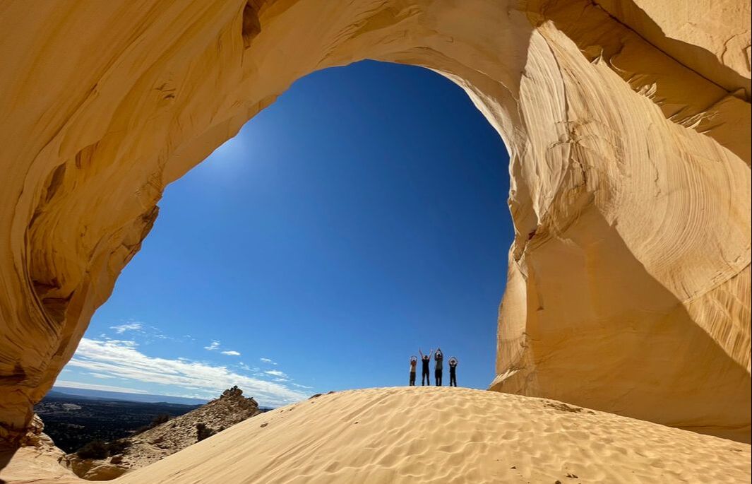 O-H... Along the trails we rarely saw anyone else. The benefit of being escorted by a local meant he knew the back country like the back of his hand, and he knew the best sights to go to-- often ones the tourists haven't discovered. He prefers not fighting the crowds, just like we do! We stopped for lunch by some really neat hoodoos and the kids got to do some rock climbing before he hit the trails again and headed for Peek-a-boo Canyon. Having a guide also helped us understand the dangers of the area, which are often underestimated by people passing through. Slot canyons in this area have seen a huge influx of people in the last few years. Places like Antelope Canyon or The Wave have wowed the Instagram world with vibrant photos of curvy, narrow striped sandstone walls. Everyone wants to go to one (including us), but locals have had to do plenty of damage control with this influx of tourists. This country is straight up rock with no soil to absorb rain, so even with a short rain shower, water runs off the high plateaus into these slot canyons, creating treacherous flash floods without warning. Just a month and a half ago, four women were washed down stream at The Narrows in Zion and one lost her life...and this is a fairly common occurrence. When rain isn't in the forecast, it's important to remember that sun typically is, and there is a high chance for dehydration. Often, tourists think that since these canyons are popular destinations, there isn't much danger. Our guide, who volunteers with local search and rescue, said 35% of the squad's rescues come out of North Coyote Buttes where The Wave is found. Because of this, hiker restrictions have been put into place. Antelope now only offers entrance by tour reservation, and a limited permit system (with in-person safety brief) has been put in place at Coyote Buttes. If permit holders aren't comfortable doing Coyote Buttes on their own, they can hire tour guides from Kanab Tour Company. Peek-a-boo Canyon is a hot local tourist stop because, unlike Antelope Canyon and The Wave, you don't need a tour guide or a permit. However, you do need a four wheel drive vehicle. We personally met two people who have attempted to drive their personal vehicles back there and got stuck. We were thankful to have some high power UTVs and a guide who knew the best route. We finished our day zipping around on some sand dunes, then began our hour drive back to Kanab, stopping at some overlooks and going back through the Hog Canyon trails on the way. By the time we arrived back to the office, we had spent almost nine hours out and covered 71 miles.
We highly recommend Kanab Tour Company. They offer UTV rentals (without guides), but if you're not familiar with the area, a rental just sounds like a waste. There were many roads we drove the with guide that we NEVER would have attempted on our own! His expertise made for a great day, taking carefully managing chances in safe ways, and seeing wonders of history and nature that we wouldn't have known existed. When we come back to Kanab someday, we would love to do a guided canyoneering tour with Kanab Tour Company, and we highly recommend them to friends and family! Tucked between striped plateaus of bright orange, Kanab, Utah is a home base for people traveling to Zion and Bryce National Parks and the Grand Staircase Escalante National Monument. These desert plateaus aren't just beautiful; the area is also a hotbed of history, geology, and adventure. A short visit to Kane County Visitor Center is a testament to just how much there is to do in the area. We stayed eight nights in Kanab and we only scratched the surface. In addition to our "big" days at Bryce Canyon, Zion National Park, including Angels Landing, and our four wheeling tour, we took a few short hikes and short day trips. This post is a fun reminder to us of all the fun we had there and also a travel guide for anyone planning a trip to Southern Utah. 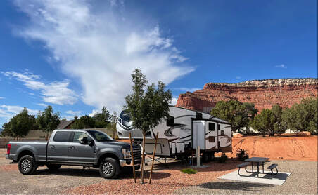 Southern Utah is like nothing else in the world. The orange mesas and plateaus are stunning, which is why we were quite pleased to pull up into our reserved spot at Grand Plateau RV Resort and find ourselves right between two beautiful mesas. This brand new campground truly is the finest in the city. With reasonable rates, level sites, and an excellent pool and hot tub, this is a place one could stay for a while and not get bored or tired of the scenery. Kanab is a tourist town and the Kane County Visitors Center is one of the best I've seen. The area is packed full of amazing hikes, and the county provides free fliers with descriptions of each hike, including a map and safety tips. We picked a few top rated trails that fit our schedule. Dinosaur Tracks TrailJust outside of Kanab is a short mile long trail that takes you up to the top of a mesa where you can find 1.8 million year old theropod dinosaur footprints! Kanab Sand CavesDriving into town from the north you pass the Kanab Sand Caves just off the side of Highway 89. They're up fairly high and you wouldn't think you could get into them, but of course people have found a way. Apparently these man-made caves were formed when they began mining for sand in the area. Now, visitors climb a fairly steep slippery sandstone cliff to get up to the trail that leads to the caves. Coral Pink Sand DunesLeaving Kanab, you'll find Hancock Road, which will take you to Coral Pink Sand Dunes State Park. It also takes you down a sand road to some pictographs made by the Basket Maker People between 452 AD and 62 BC. We attempted this 5 mile drive to South Fork Indian Canyon, but chickened out two and a half miles down the road when we came upon an area of deep sand at the base of a dune and saw lightning in the distance. It was a fun drive bouncing along the road in Archie, but we decided it might be best to stick to the asphalt roads to the state park instead. For a fee of $10 (or $5 with military discount), patrons can visit Coral Pink Sand Dunes State Park. With so much sandstone and so little water, the winds pick up sand and carry them between two mountains, dropping them when they become too heavy to carry above the mountain. We were able to get a sled from our campground and sled down for an evening of fun. We watched a storm roll in from the south and the sun set in the west. Toadstools HikeWe Ramseys (or at least some of us) like to make the most of every hour of daylight, so one evening around 6:00 (before dinner), we drove 45 minutes south of Kanab to do the two mile Toadstools Hike. We followed a wash bed trail to a bizarre environment with orange toadstool formations in otherwise white limestone scenery. Toadstools are born from the uneven erosion of sedimentary rock. When a harder layer forms atop a softer rock layer, the lower rock gets eroded away more quickly than the harder layer on top, creating these toadstools, or hoodoos, that are common in this area. Say it with me: "Geology is SO COOL!" These were four short trails with big rewards, and we have a file folder full of other hikes we didn't even get to. This area of southwest Utah is a hiker's paradise! Have you ever been? And if so, what are your favorite hikes or things to do?
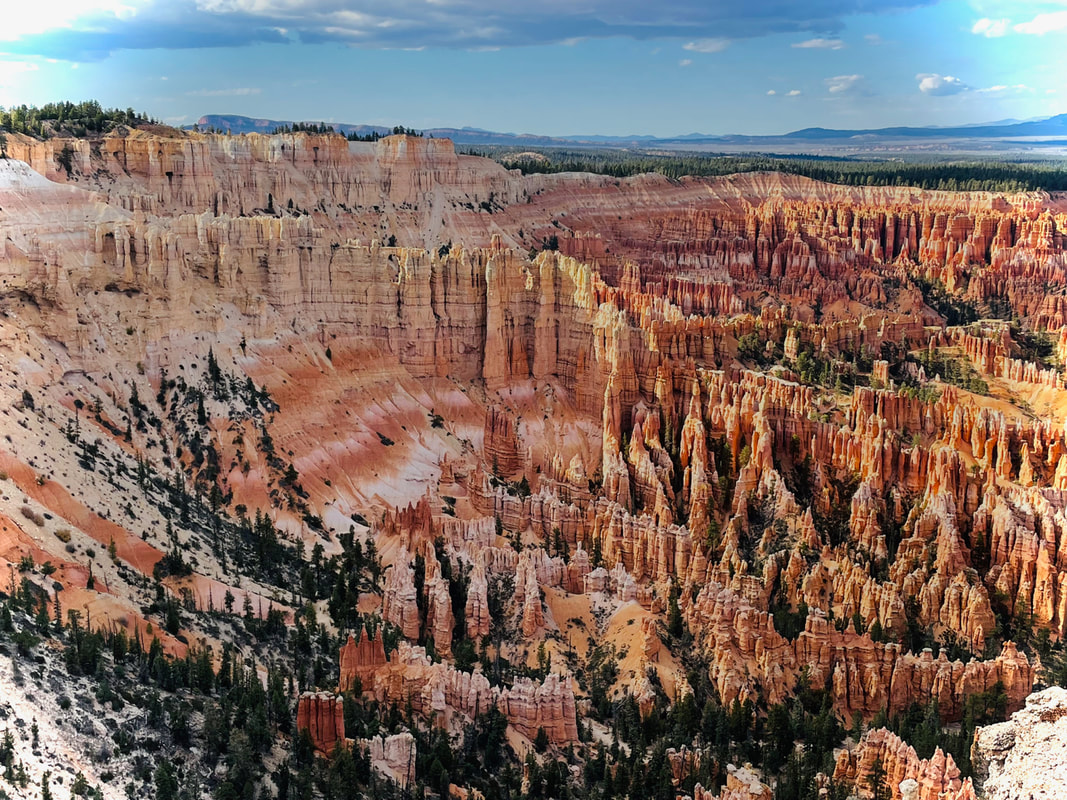 Amphitheater, Bryce Canyon, Utah Southern Utah was the part of this extended vacation that we were most excited about. With five national parks and eleven national monuments and historic sites, there is no doubt that this section of our country is something special! We spent eight nights in Kanab touring the southwest section. You can read more about our adventures in Zion, four wheeling around Kane County, and short hikes around the area on our blog. We spent our first day at Bryce Canyon National Park. I've been trying to think of the best way to describe the wonders of Bryce Canyon, but honestly, I feel like this post is best described in pictures. Unique erosion has created one of the most awe inspiring landscapes that our earth has to offer. We spent a few hours driving through the park, guided by our trusty GyPSy Guide*, and stopping at all the overlooks. By the time we got back to the amphitheater, the most famous section of the park, we were ready to get out of the car and really see things. We descended the canyon and hiked the Queen's Garden and Navajo Loop trail, approximately 3.5 miles. With that, I'm going to leave you to a slideshow...because a picture is worth a thousand words. * Contains affiliate link.
Zion is a beautiful place, but in our opinion, it's almost impossible to enjoy without getting into the "back country". At most parks you can typically see lots of sights from inside your car or stop at overlooks for beautiful views, but Zion is not the place to do that. (You're more likely to be looking at the back of someone's head as you're crammed into standing room only spaces on the shuttle.) There are two main hikes that are world renowned: The Narrows, which is wading upriver through a narrow slot canyon, and Angels Landing. 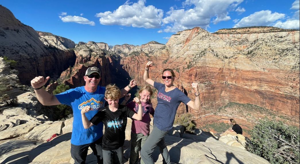 Preparation for the HikeIn the past, Angels Landing was seeing up to 4,000 climbers per day. All those people climbing up and down a narrow two-way sandstone mountain fin with drop offs on both sides is a recipe for disaster. In both 2019 and 2021, one of the 300,000 hikers per year died from falling off the mountain. Yes, I know...I didn't like those odds either. Fortunately, the national parks system is working to remedy overcrowding. In 2022, they began a lottery system at Recreation.gov for hiking Angels Landing. Visitors have two options: enter the quarterly lottery (if you know preferred dates for your hike) or enter a lottery between 12:01 a.m. and 3:00 p.m. the day before you hope to climb. A maximum of 900 lottery winners are spaced in three time frames throughout the day. We entered the lottery Monday afternoon and found out at 4:00 p.m. that we won!! We had reservations for Tuesday afternoon. Before we considered taking our kids on this hike, we talked to multiple people who had previously reached the Angels Landing summit. We read blogs about doing the hike with children. None of the people who had done the hike before said it was something we should not do. We knew our kids had the stamina, balance, and the technical skills to climb, but our concerns had nothing to do with their abilities. Crowding on the mountain was our worst fear. We conferred with rangers and read reviews on All Trails to get the timing right. Next, we had to be sure the kids were mentally prepared--and wanted to go. We showed them video footage and photographs and explained the trail to them. They were more than excited for the climb, but we also emphasized to them that if at any point they decided they didn't want to go forward, all they had to do was say the word and we would turn around. (We also threatened Brickhead that if he pushed the boundaries one time he wouldn't be allowed to continue.) Lastly, we checked the weather (perfect sunny 80 degrees) and made sure everyone had the right gear. Sturdy hiking boots were a must, as was a backpack with plenty of water, snacks, and sunscreen. (And of course, don't forget a first aid kit just in case!) Our Experience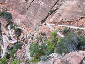 We left The Grotto shuttle drop off point around 1:00 p.m. in hopes of avoiding any major crowds. As we ascended the 2.2 miles up switchbacks on West Rim Trail, the sun beat down on us. We continued through a canyon, which allowed for a little more shade, then on to Walter's Wiggles, a series of 21 steep switchbacks that lift the hiker up 1,000 feet in elevation. From there, hikers can take a break at Scout Lookout where the Rim Trail splits into the optional, and permit-required Angels Landing. We sat at Scout Lookout for a while debating if we were going to take the plunge or not. A view of the trail is quite daunting. Hikers were describing the next half mile section where you gain another 500 ft in elevation as two narrow "humps," or sandstone fins, with 1,000 foot drop offs on both sides. Many people turned back after the first hump, saying it was "too sketchy," but quite a few who did the whole trail said it was great, well worth the trip, and not near as dangerous as photos (and views) made it seem. It seemed more a mental battle than a physical one. We decided to give it a try. After all, the crowds had died down by 3:15, and we figured we could always turn around if we needed to. The kids reminded us to always maintain three points of contact, so we continued through the trail, holding on to the chains at all times. Fortunately the many hikers who came before have eroded footsteps and handholds along much of the trail. There were plenty of spaces to step aside and allow others to pass, and everyone was really supportive of the kids braving out the trek. Brickhead followed all directions and did what he was supposed to do, and Banana was super encouraging, making sure I knew where I should step in any tricky parts. Both of them said repeatedly that the trail wasn't near as scary as the photos made it seem and it was much wider than they thought it would be. We're just so proud of their excellent climbing skills and hiker etiquette. It took about an hour to climb the half mile to the top, mostly because we would stop and wait for any hikers coming down before we attempted any narrow passageways. (It's important to not be in a hurry on this trail.) The views from the top were gorgeous and we had good company, sharing lots of laughs with strangers and celebrating our victories. Then it came time to go back the way we came. Let's just say the kids, with their strong, young bodies, did much better than I did. All together, the adventure took just short of five hours from start to finish. Should You Do It?I wouldn't say that Angel's Landing is a "Bucket List" item--it's more of a bragging right. The views are cool, but you can get better views on safer hikes. You need to be in good shape, and if heights scare you, this likely isn't the hike for you. Having just the right amount of confidence in yourself allows for a safe trip: overconfidence can kill you, and lack of confidence can cause you to freeze at inopportune times. Bring plenty of water, because you're going to need it, especially in the hot summer months. Most importantly, be prepared. 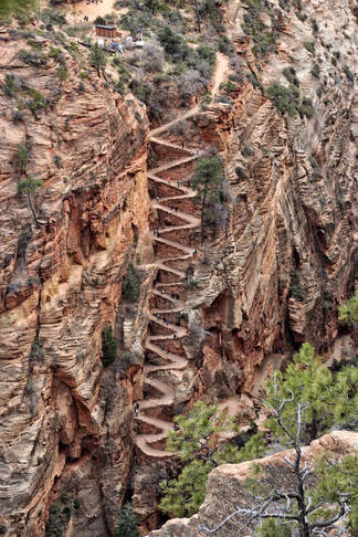 Walter's Wiggles, courtesy of Zion National Park's Facebook page. Walter's Wiggles, courtesy of Zion National Park's Facebook page. Should you take your kids? You know your kids better than anyone else. We talked to three park Rangers before starting this hike and none of them batted an eye at us taking our ten and twelve year old up. Kids do this hike. But kids need to have plenty of hiking experience: they need the endurance to climb to such elevations in a short distance and they need to be sure-footed and have good balance. Most importantly, they need to be able to follow directions and practice the "three points of contact" rule. Parents need to be willing to turn around if the task seems too difficult for the child.
We all said the hike wasn't as difficult as we thought it might be (aside from those 21 switchbacks! Those were killers!) I personally don't know that I'd do it again, but not because Angel's Landing was scary or difficult. At the risk of sounding redundant, I just didn't find the switchbacks to be worth the reward! Plenty of other hikers said the views were top notch though, so don't listen to me. If it's something you're interested in, give it a try! We're glad we did it...even if it was just for bragging rights. 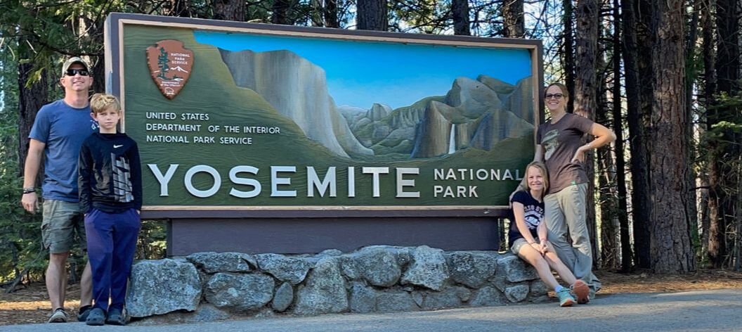 John Muir once said of Yosemite Park, "None can escape its charms. Its natural beauty cleans and warms like a fire, and you will be willing to stay forever in one place like a tree... But no temple made with hands can compare with Yosemite. Every rock in its wall seems to glow with life.” The Yosemite Valley truly is one of the most awe-inspiring places on earth. With El Capitan towering 3,000 feet to one side and Half Dome soaring at 4,737 feet on the other, the view is a humble reminder of our insignificance in this big ol' world. Traditionally, Yosemite has always held a special place in the hearts of my family. My grandpa has been roaming those mountains since he was a toddler. Forty some years ago my grandparents built a cabin in Greely Hill, about an hour west of the park entrance. Twelve years ago they built a house on that property and now live there full time. Since even the grocery store is an hour away, they consider the park to be right next door. You could say they know the Sierras like the back of their hand, and Yosemite has always been a favorite spot. 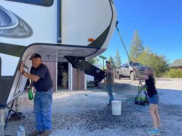 Every one of my aunts and uncles has climbed the famed granite Half Dome monolith at least once. My grandpa has climbed it 26 times, my grandma 8. It's not an easy feat and it's a pretty cool family tradition. Over the years, though, things have changed. As more and more people have come to visit the park each year, roads have been rerouted. Parking lots have become over-crowded. A shuttle system has been implemented and pretty near mandatory if you want to stop and explore certain parts of the park. Traffic wait times have peaked at 2-3 hours. This year the park began requiring a reservation (made online at Recreation.gov) before you can enter the park, even if your intent is to drive through the park via state route 120 over Tioga pass, which locals have used since 1919 to get to the other side of the mountains. This population problem has led to my grandparents vowing to never go back to Yosemite again, a truly heartbreaking sentiment, and a testament of the times. All that being said, Yosemite was on our radar for this cross-country trip, but since we have been there several times, it wasn't a priority. What brought us to California was spending some quality time with FAMILY! We arrived at my grandparents' house on Friday and were greeted with a delicious dinner of beef stew, muffins, and homemade applesauce. Grandpa had us sufficiently hooked up with 30 amp power, water, sewer, and internet in no time. If we thought that was full service for a "moochdocking" stay, the next day grandma and grandpa took it to the next level. While I got all our laundry and schooling done, the guys changed the oil and rotated tires on the truck, scrubbed all the mud and bugs off the rig, and stapled wall panels that had been shaken loose during Rivy's 6,000 mile journey across the country. It felt so good to have a day to get caught up on those chores and maintenance that needed to get done, and we were so grateful for all the tools and space that my grandparents had so we could get that accomplished! On Sunday afternoon my aunts and uncles came over from the Modesto area to visit. Immediately my Uncle Stephen suggested wrestling with the kids. Three years ago when we visited, that's how he broke the ice, so apparently he thought wrestling a 10 and 12 year old would be a good idea. LOL! He certainly has a way with kids and it definitely worked because for the rest of the night they asked if they could wrestle again. This is how they will always remember U. Stephen--I'm curious what will happen on our next visit! We had a delicious dinner of Papa Murphy's Pizza (man, how we have missed this!) and a healthy salad. My birthday was the day before, so Dusty and the kids made my favorite Dr. Pepper cupcakes for dessert. The evening was filled with catching up, laughter, stories, good food, and fun. No time was wasted as we jumped in to great conversations! Monday we decided to try our luck at Yosemite. The last time we went was May 2019 and we decided then that it was too crowded for our tastes. But...you know...FOMO. We had to go. We set our trusty GyPSy Guide* for a tour of the park, listening to history, geology, and fun facts about Muir's favorite place on earth as we drove. (Quick plug: if you find yourself in a National Park or popular outdoor tourist destination, go to gypsyguide.com and see if there is a tour available for your location. Download the app and set the tour to play as you're entering the park. The tour runs off of GPS navigation, so as you approach a conversation point, your personal tour guide comes on and tells you about the location. He's funny and knowledgeable, and it's just like having a park ranger in your car as you drive. We use this app to help navigate parks and to determine the best lookouts, hikes, and activities, plus the history and science behind the parks makes for an enjoyable and educational experience! Forget driving blind. Get the GyPSy App. I promise, I don't get paid for this ad.) Our first stop in the park was to Tuolumne Grove, one of the larger groves of Giant Sequoias in the park. (Tip: If you want to see giant Sequoias, go to Calaveras Big Trees State Park. We didn't go this time, but what you see there is definitely worth the drive!) We hiked about a mile on a downhill paved road to the grove. The first fallen sequoia we came to, Brickhead got stung by an angry yellow jacket (or meat bee, as Grandpa calls them). We climbed through another fallen tree, then made our our own beeline back to the truck for some first aid. Thankfully, stopping at the El Capitan Bridge to watch the climbers took the sting off Brickhead's mind. What looked like a tiny house spider on a wall was actually a fairly large bright orange bivy tent and gear someone had set up for sleeping on the side of the cliff. With binoculars we spotted about six climbers that you could barely see with the naked eye. That granite monolith is just so enormous! We met Tom Evans, a professional photographer who captures the climbers in action. We didn't realize he was a celebrity in his profession, having been the only still photographer to catch Alex Honnold complete his 2008 famed three hour and 56 minute free-solo climb of El Capitan. He briefly told us of his climbing adventures and what these climbers have to plan for. Some of them spend more than two weeks climbing to the top of that wall! Before we left, we met two girls who had just finished a two day climb. Absolutely amazing. A little ways down the road, we stopped at a gently moving spot on the Merced River to wade in the cold water. John Muir said the Merced River was the most joyful stream born in the Sierra. "The sun shines not on us, but in us. The rivers flow not past, but through us." He was right...there is just something about wading in living waters that makes you feel...connected. 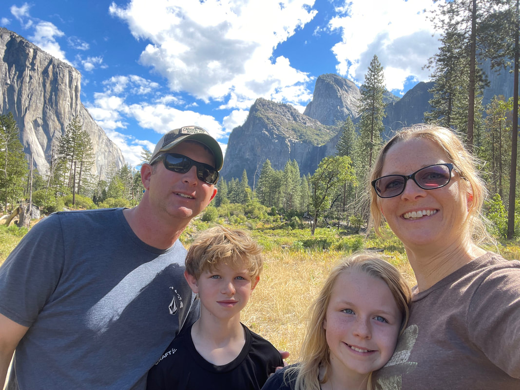 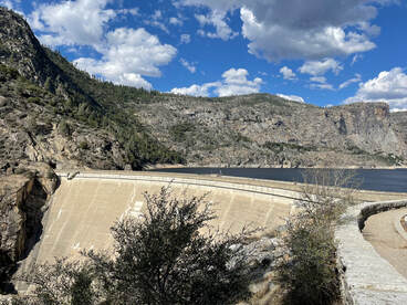 Upon entering the Valley, it was immediately apparent that people were going to ruin this trip. (My grandma jokingly reminded me that I am some of those people! While that is true in a sense, it's a different kind of people who wreck the experience for everyone.) We didn't get further than the first pull-off that we heard no less than three car horns from different angry drivers frustrated by someone slowing down in front of them to take a picture or cutting them off to change lanes or park their car. In case your background does not provide you with this important bit of information, you should know this one fact: angry car horns do NOT belong in nature. Especially in one of the most beautiful places on earth. My patience with people ran out right then and there and I knew spending time in the busy section of the park was going to be a "no go" for me. From there, I drove around the parking lot a few times (because there was no parking availability) while Dusty and the kids ran to the gift shop for collector's tokens. Then it was time to escape! On the way out, we took a drive to Hetch Hetchy reservoir to walk across the dam. Three years ago, Grandpa took us out that way and told us about this controversial location. We listened to the story then, and were elated a half a year later when a homeschool field trip to our Nation's Capitol turned the story into a lesson on congressional voting. (Thanks to COVID, you can now find the interactive lesson here on the Capitol's website. I highly recommend a visit, especially for middle school kids--or adults--who would like to find out more!) If you don't have time though, here's a quick history lesson. You remember the 1849 Gold Rush, right? San Francisco’s population went from 1,000 people in 1848 to a whopping 25,000 by the next year. By the late 1800's, the city was desperately searching for alternative sources of water. In 1906, a major earthquake destroyed much of the city, breaking gas lines and igniting debris and spreading to structures that survived the quake. Lack of water made firefighting impossible. As they rebuilt they knew they needed a fresh water source, and Hetch Hetchy seemed to them the best solution to their problem. But the valley, which had been described as the twin of the Yosemite valley, was on protected land of the National Park. For over a decade, the city lobbied congress in hopes to gain approval to dam the valley in order to create a reservoir. In 1913, environmentalists finally lost out and the damming of the Tuolumne River was approved. The O’Shaughnessy Dam was constructed and a 167 mile aqueduct was built to deliver some of the cleanest water in the country to what is now 2.6 million people in San Francisco. The existence of this dam is still a matter of huge controversy in the area, and a vote went out a few years back to tear down the dam, restoring the valley to its former glory. Again, environmentalists lost and the dam still stands. After our quick visit to learn about this famed dam, we headed back to Grandma and Grandpa's for dinner. We spent the next day planning our future route and asking Grandpa for his expertise. As mentioned, he knows the Sierras like the back of his hand and was a wealth of knowledge about roads all the way through to Utah and Arizona.
We had a wonderful visit with my grandparents. I can't thank them enough for all of their hospitality and help with getting all our much needed maintenance and chores done. We don't get many opportunities to visit, so every time we do, I learn more about them. I thoroughly enjoy listening to their stories and am constantly amazed by the life they've shared. (I never realized how much time they've spent backpacking in the mountains!) I so admire their love for each other and all they do to keep involved and stay young! They are truly an inspiration and set a good example for the life our family hopes to live out together. Thank you, Grandma and Grandpa! We love you and are already looking forward to our next visit. *Contains affiliate link 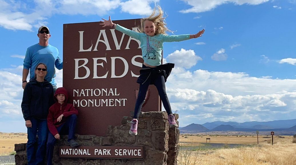 The photo above makes me laugh so much. It's becoming a tradition for Dusty to try at least 4 times to get "the perfect photo" in front of these signs. Sometimes we even have to go back to the signs multiple times for the perfect lighting or if a helpful visitor didn't get the right angle. We all work hard to sit/stand, smile, and look perfect before the timer goes off. This time Jana decided to throw Daddy for a loop and jump just as Dusty got into place. And it turned out perfect! LOL! To review: Traveling south from eastern Washington, the skies filled with smoke from nearby wildfires, but one thing remained clear: the area was a hotbed of volcanic activity. You've likely heard of the Ring of Fire which encircles the moving tectonic plates of the Pacific Ocean. Within this ring are 452 active and dormant volcanoes, which accounts for nearly 75% of the world's volcanic activity, and about 90% of earthquakes. The west coast is full of opportunities to learn about, explore, and experience these forces of nature, so we made a few stops on the way south. Lava Beds National MonumentJust across the California border is Lava Beds National Monument. This park boasts over twenty caves of varying difficulty that visitors can explore. Unfortunately, most of them were closed when we visited. Bummer for us! On the plus side, if you choose to arrive any time in the near future, you'll be driving on smooth, newly paved roads throughout the park to get to your cave crawling destinations! Lava Beds is more than just stories of eruptions; it has been home to the Modoc people for over 10,000 years. The park does a remarkable job teaching Modoc culture and honoring their history, including the historic battles of the Modoc War, fought in the northern part of the park. If you're interested, be sure to pick up some pamphlets from the visitor center.
Eventually droves of people began moving to and through Oregon and south via the Applegate Trail through Modoc ancestral lands. Some new settlers were ruthless murders who coaxed their way into Modoc villages to murder men, women, and children. Our government considered natives to be "in the way" of progress, so they began promising better lives-- provisions of food, shelter, and clothing-- in exchange for relocation.
The fight didn't end well for the Modocs. If winning could be decided by tallying casualties, the natives certainly should have won, but that's not the way it ever ended. Desperate, the tribe eventually gave up and returned to the reservation. The beautiful lake which their culture relied on was drained and turned to farmland. Their way of life was nearly erased. Thankfully, some traces of the Modocs still remain. In places like Symbol Bridge and Big Painted Cave, visitors can barely see paintings left on the cave walls. But those paintings are nothing compared to the carvings one can see at Petroglyph Point Trail. This short trail takes you along a cliff wall filled with 5,000 individual carvings. But, again, there is something strange. The carvings are 9+ feet high on the cliff wall. How could they have carved this artwork so high? What now is a flat, wide expanse of wavy rock used to be Tule Lake, and the cliff used to be an island. As the carvings are suggested to be up to 6,000 years old, it's possible that generations of Modocs paddled out in canoes to carve into the soft volcanic rock. Sadly, much of the customs or meanings behind these petroglyphs have been lost as that information was not able to be passed down through the generations. The history geek in me loved the stories of Modoc culture, while the geology geek loved the lava! Throughout the park, lava flows take on different forms, sometimes jagged boulders and sometimes fairly smooth flows that even left behind casts of trees it took down as it slowly cooled. We learned the difference between a crater and a caldera. A crater is a lava vent that has filled up or closed off. A caldera is formed when the mountain implodes as the magma chamber collapses. For this reason, scientists have been asking for Crater Lake to be renamed Caldera Lake for decades. Lava Beds NM does actually have several craters though and visitors can easily hike to them. As mentioned, you can also find lots of lava tubes caves here. We were only able to see Skull Cave and Mudpot Cave, both "eh" on the scale of excitement. If we had the chance to come back again, we would definitely make sure the caves were open! We've heard from several people that they are pretty top notch and you should make sure to bring flashlights (and back ups!) Lassen Volcanic National Park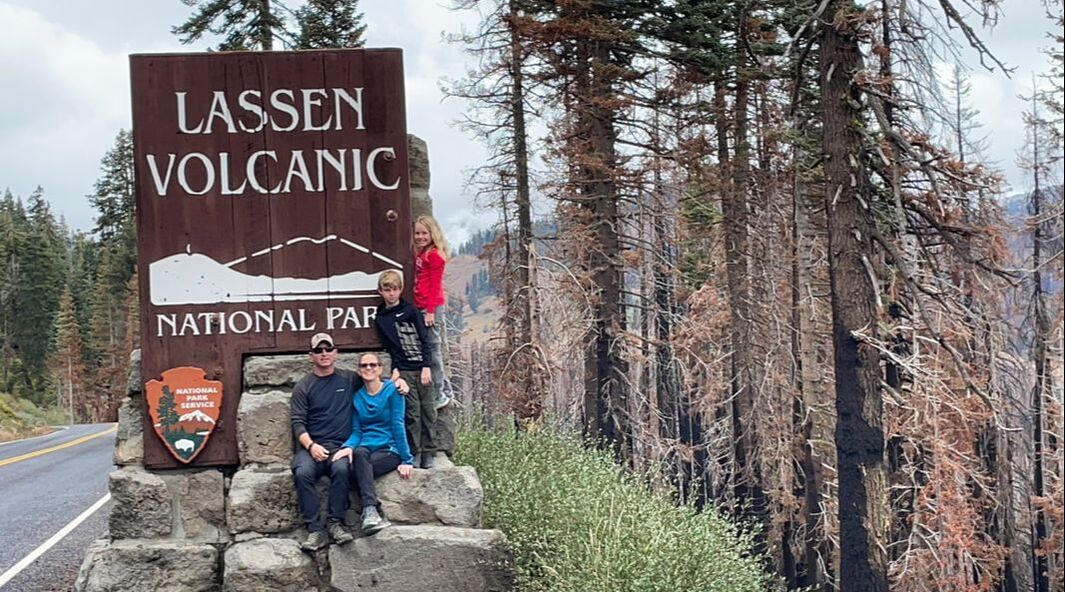 Maybe you've heard California is in a terrible drought. I'm not sure how long it's been since they've had rain, but judging from the wild fires, numerous dried up lakes, dusty earth, and dried up crops, I'm guessing it's been a long while. The Ramseys have been enjoying beautiful weather throughout our entire trip, but luck ran out when we arrived at Lassen. Or you could say we brought good luck with us! Because the day we arrived, it poured for hours! So much so that the higher elevations of Lassen got up to 5 inches of snow, closing down about 20 miles of the road through the park that connects the North and South entrances.
The next day, the kids and I stayed home at our dirty trailer park campground (Lassen West Village is NOT recommended!) to do some school work, but Dusty was determined to see more of the park. He drove around to the north side and visited the Butte and Manzanita Lake sections of the park and what he saw and did that day put Lassen at the very top of his favorite parks list. Not having been there, I think this post will best be told in pictures.
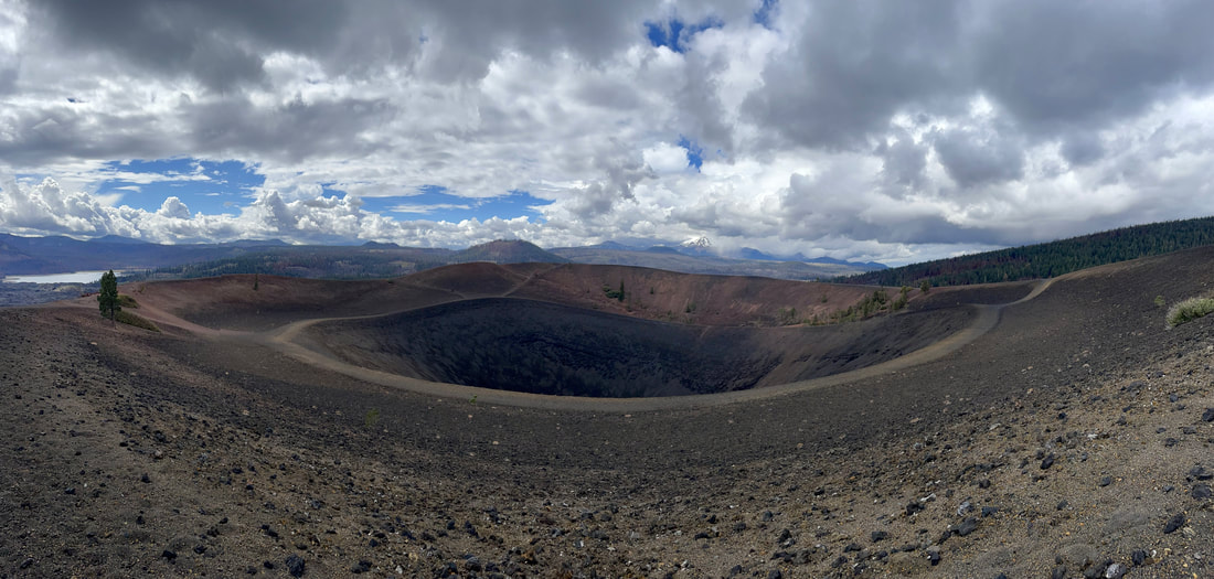 Cinder Cone Crater 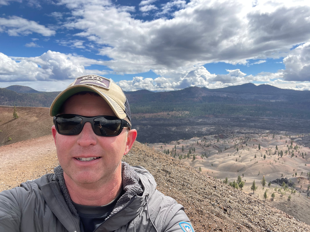
Lassen is one of the few places on Earth where you can find all four types of volcanoes: a shield, composite, cinder cone, and plug dome. After his Cinder Cone climb, he drove on to the north entrance for better views of Lassen Peak, one of the largest plug dome volcanoes in the world. He drove the 20 miles of the park road that were open, then returned to Lake Manzanita and waited out a thunderstorm to get a good view of the peak's reflection in the water. The solitude gave him time to sit with nature and relax in the peace and quiet, leaving him glowing and recharged when he got home. Our trip to Lassen wasn't what we expected due to road closures, and because of the Dixie fire that raged through much of the park in 2021, leaving many trails closed. Bumpass Hell, a hydrothermal hotbed of activity, and major park attraction was completely closed off, and we've decided that, given the chance, we would love to come back and explore what we missed (or see it again, in Dusty's case.) 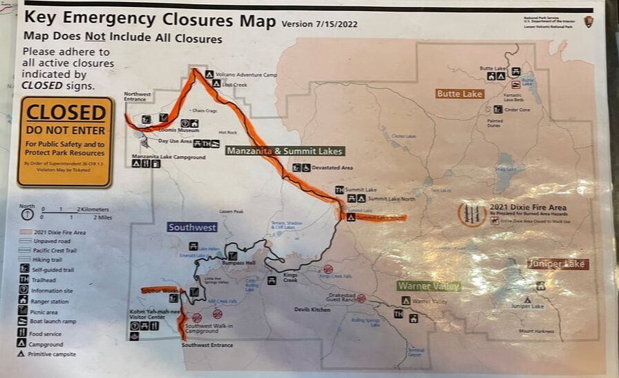 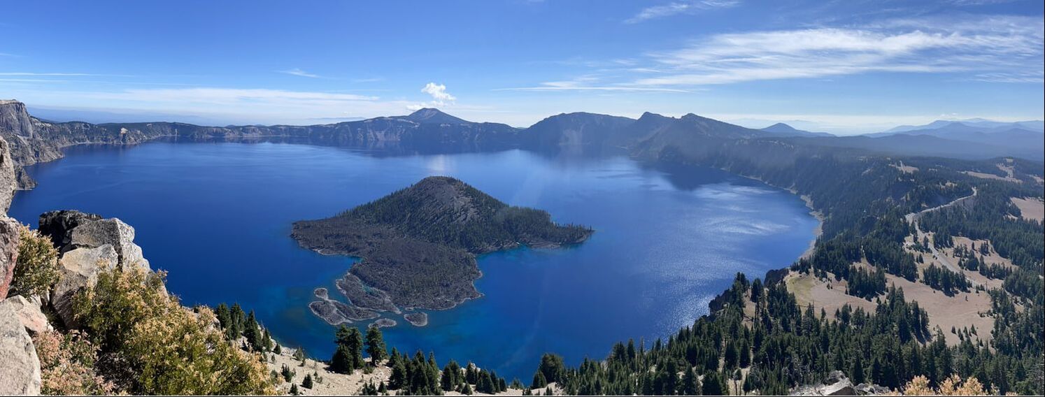 Traveling south from eastern Washington, the skies filled with smoke from nearby wildfires, but one thing remained clear: the area was a hotbed of volcanic activity. You've likely heard of the Ring of Fire which encircles the moving tectonic plates of the Pacific Ocean. Within this ring are 452 active and dormant volcanoes, which accounts for nearly 75% of the world's volcanic activity, and about 90% of earthquakes. The west coast is full of opportunities to learn about, explore, and experience these forces of nature, so we made a few stops on the way south. Newberry National Volcanic Monument Ever heard of Newberry? Yeah, neither had we. Traveling south on 97 near Bend, Oregon, we were struck by the sudden lava bed of basalt boulders and a small cone volcano right next to the highway. We made a quick exit at the Lava Lands Visitor Center and met some engaging rangers who sold us on coming back later to explore. (We needed to get to our campground before they closed the gates and made us spend the night in the pizza shop parking lot. Literally--that's what they told us.) Newberry is the largest volcano in the Cascade Range. Born some 500,000 years ago, its eruptions have covered 1,200 square miles and have produced over 400 volcanic vents and cinder cones (those perfect little cone volcanoes with the round vents on top) during its active periods. Much of the park centers around the five mile wide Newberry caldera, which includes lakes, hot springs, waterfalls, and obsidian flows. We drove an hour and 45 minutes north of our campground in hopes that the trip would be worth our time, and Newberry did not disappoint. We started our adventure at the park's youngest lava flow, the Big Obsidian Flow. This eruption occurred 1,300 years ago and produced a slow, 150-foot thick flow of lava. When the Ranger told us the flow was 10% obsidian, I didn't expect to find much. Boy, was I wrong! Native American tribes used to travel for days to stock up on a year's supply of obsidian for arrowheads and tools, but even with those stock piles removed, the boulders of shiny, black volcanic glass were scattered everywhere. (Fun facts: Surgical blades made of obsidian are sharper and allow for faster wound healing. More fun facts: Back in the 1960's, scientists from NASA came to the flow to extract water from rocks, in hopes of discovering a way to live on the moon.) Our kids have been dying to find a hot spring since we traveled to Iceland in 2017. Part of the draw to our visit to Newberry was real hot springs you could swim in, so we were sure to pack our suits and towels. The ranger told us it was a short 1.5 mile hike to get there. As it turns out, it was almost a three mile hike, and at about 2.7 miles in, a big clap of thunder rang through the mountain. Something we hadn't prepared for was a storm. But after hiking much further than we had anticipated, nothing was going to stop us from soaking in those springs! We continued on, found a copse of trees to change in, and rushed through the cold air to the hot springs, dodging raindrops along the way. Then... as soon as our bottoms hit water, it started to hail! Then hailed some more. Every time we thought it was going to let up, it started hailing harder. So, there we were, laying in this primitive, shallow gravel bed at the edge of Paulina Lake while small balls of ice pelted our skin like needles. We toughed it out for a good 15-20 minutes until it really let loose, followed by a louder clap of thunder that caused us to skedaddle real quick! After leaving the hot springs, we had the pleasure of walking over a nice bed of ice balls to change into our partially wet clothes and hike back! Ahh...the memories! Newberry is considered a National Monument and isn't advertised like the parks are, but is well worth a visit. It's still an active volcano and has nine United States Geological Survey monitoring stations to detect early and subtle signs of activity. The campground only has room for smaller RV's and tents, but is a peaceful area right on the lake. The obsidian flows are phenomenal, and worth the visit in themselves. Newberry can easily be paired with a trip to Crater Lake. I'm sure the hot springs are much more relaxing when it's not hailing, so always be sure to check the weather before you go! 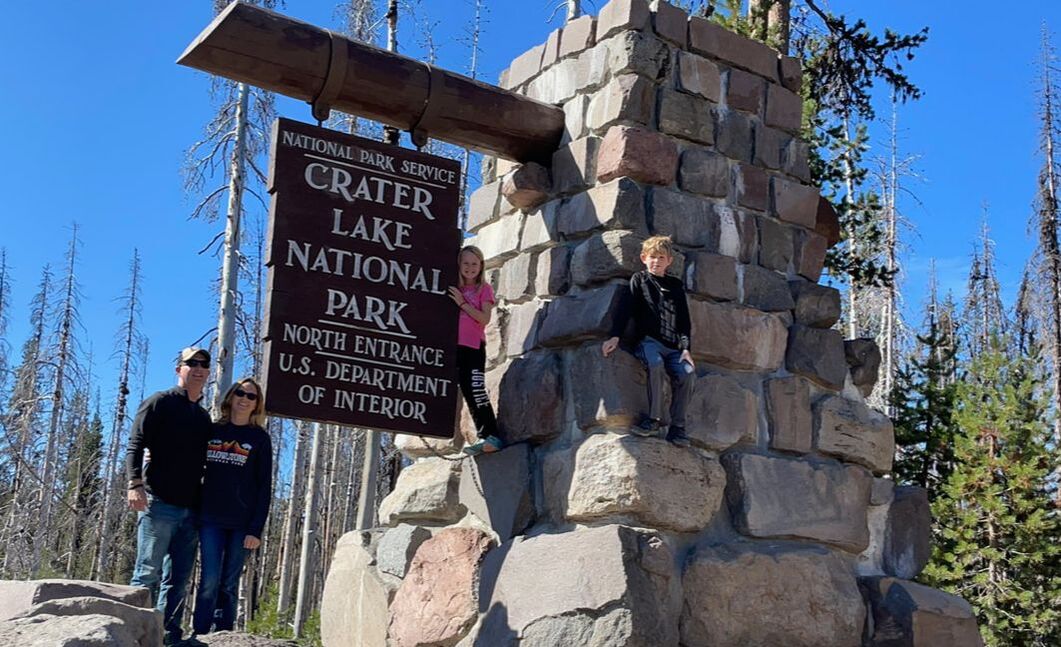 Crater Lake National Park Seven thousand, seven hundred years ago, Mt. Mazama (go ahead--say that out loud) stood 12,000 feet tall, but beneath its snow-capped peak, the earth was angry. Heat and pressure built up in a magma chamber below until an eruption 100 times the magnitude of the 1980 eruption of Mt. St. Helens emptied its chamber, causing the summit to implode. Left behind was a caldera (not a crater, as you'll later find out in Part 2) averaging 5 miles wide. Over time, rain and snow fell into the caldera, creating the deepest lake in the United States at 1,943 feet deep. Since there are no inlets carrying sediment or pollution into Crater Lake, the water is actually cleaner and clearer than what comes out of your faucet at home. We stopped at Crater Lake in May 2019 during our west coast trip, but the winter snowfall still had the main visitor section under six feet of snow and most of Rim Road was impassable. During our first visit, we were absolutely awestruck by the beauty of the crystal blue lake, offset by the white snow all around. This trip was different given the slight haze leftover from wildfires nearby and wind that disturbed the smooth glass of the lake. Nevertheless, you can't visit Crater Lake without being wowed. 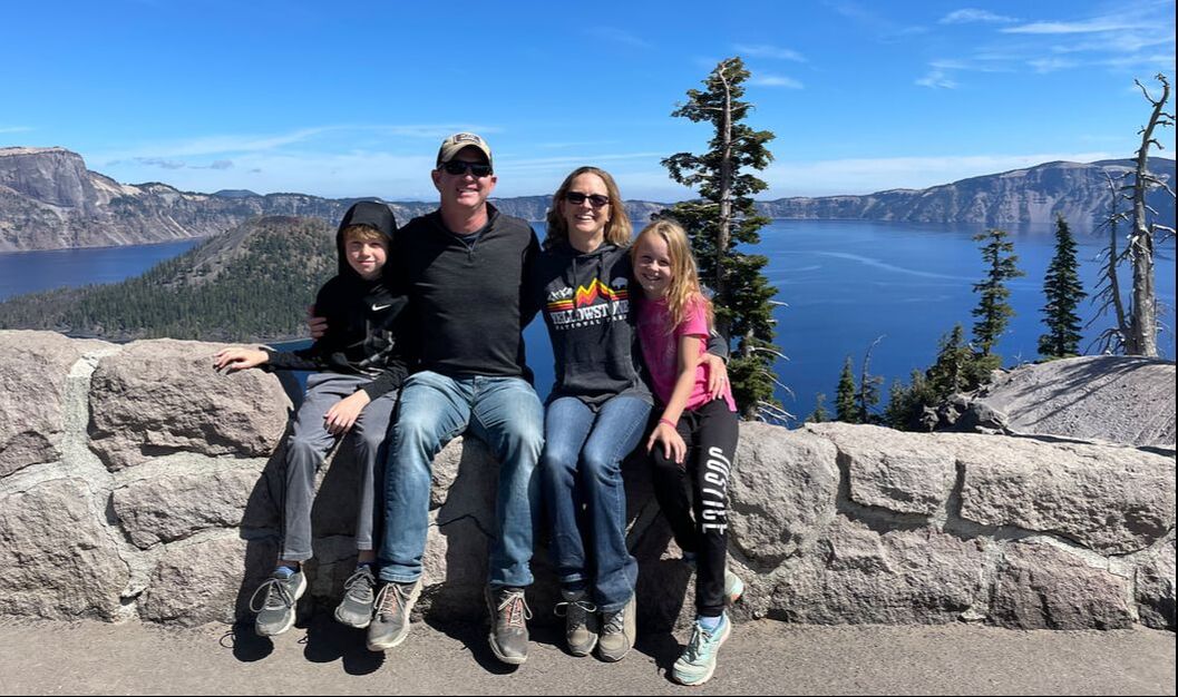 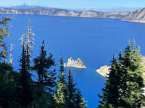 We spent the day driving the 33-mile Rim Road, stopping at major overlooks, and taking lots of photos like good tourists do. We climbed Watchman Overlook for a view of Wizard Island, a cinder cone volcano that erupted out of the lake about 7,300 years ago. (Fun fact: three other cones have erupted under the lake, but don't reach the surface.) We spotted the Phantom Ship, an island that looks like a ship sailing away from the shore, and did an easy hike out to Plaikni Falls. We finished our visit with a hike down Cleetwood Cove Trail, the only lake access point in the park. Here, visitors can board tour boats (no longer running when we arrived), or go for a swim in one of the cleanest lakes in the world. We zigzagged down the steep, ashy path and were surprised when we got to the bottom. The access point was just a huge pile of boulders! We didn't find a spot to swim--it was too cold for that anyway--or even wade, really, so we each found a spot to stick our feet in the water just so we could say we did it! Crater Lake is certainly one of America's most beautiful locations. If you go, be sure to look for Old Man of the Lake. This vertically floating log was originally found floating in the lake in 1896. It's splintered white trunk sticks up about four feet out of the water. Peering down through the clear water, you can still see the roots below. But this tree isn't rooted in place; it floats--vertically, I remind you--through the lake and can be spotted in different locations each day. We didn't find out about this until the day after we arrived, so if you find it, we want photos!
We continued our adventures through the Ring of Fire as we traveled south to Lava Beds National Monument and Lassen Volcanic National Park. You can read about those stops in Part Two of We Fell In to a Burning Ring of Fire. Until then, I'm curious, what areas with volcanic activity have you been to, and what (or where) surprised you the most? 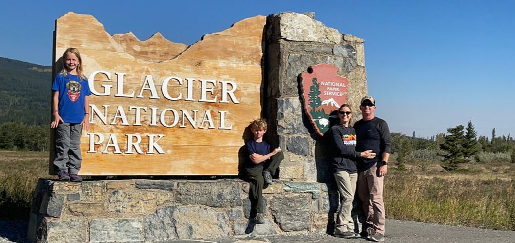 After a refreshing long weekend with long-time friends, we traveled north to Glacier National Park. Before arriving, there were four things we knew about Glacier: 1. The Going to the Sun Road was remarkable and not to be missed. 2. You needed a pass to drive the Going to the Sun Road. 3. There are a lot of people. 4. You should arrive early. As prepared travelers, we made sure to log on to Recreation.gov at 8:00 a.m. the day before our arrival to get our three day pass. But we later found out that we severely underestimated the number of travelers in the park and just how early we should arrive. You've likely heard that the National Parks have been pretty busy since 2020, so to regulate the visitor population, heavily traveled parks or park attractions have implemented a reservation system. Since Glacier stays closed under 18-24 feet of snow for most of the year, an exorbitant amount of people flock to the park during the four-month open season. Visitor reservations are supposed to aid in overcrowding, but there are some loopholes in the system. The main road through the park is closed from 10:00 p.m. to 6:00 a.m., but the entrance is still open. So, once visitors get in the gate, no one checks their reservation and they're free to go anywhere they want. Taking full advantage of the loophole, visitors without passes just wake up earlier! We talked to one group that said they entered at 4:30 a.m.! As you're about to find out, we learned passes don't really mean a hill of beans when it comes to controlling the number of visitors. We were imagining that the two hour drive along the Going to the Sun Road would have lots of stops along the way with beautiful overlooks and short hikes that would fill an entire day with activities. And, in theory, that is likely a correct assessment. So when we set out Tuesday morning, we were prepared with a packed lunch and "just-in-case" dinner, but left our day-hike backpacks at home. We were able to stop at the first pull off for views of a river and teeny waterfall, and we found parking at "The Loop," the only switchback on the mountain and an engineering marvel of its time, with beautiful overlooks. But by the time we reached the mid-way Logan's Pass Visitor Center where we would find our first hiking options, the entire parking lot was full and at least thirty cars were zig-zagging up and down rows waiting for a spot to open. We drove around the lot for about 25 minutes, then gave up. Every parking lot from there to the end of the road were completely full. We cruised out to Many Glacier at the eastern side of the park for views and hiking, but every trail there was 9-15 miles and we weren't prepared for that kind of distance that day. (Lessoned learned: be prepared for anything!) So, we returned to Going to the Sun Road, retracing our route, hoping to find parking. We drove past Sun Point: no parking. At St. Mary's Falls, the small lot was full and five cars were already waiting at the side of the road, trying their best not to block traffic. We drove back and forth, back and forth, waiting to park. Nada. Decided to drive back to Logan's Pass. The lot was so full then, that rangers had completely blocked it off and were guarding the lot entrance so no one else tried to enter. At that point, we were left with two choices: burn up fuel driving back and forth until we could park or go home. Of course going home is never an option for those with FOMO (eh-hem Dustin Ramsey). Fortunately we had our trusty GyPSy Guide* to listen to along the way. Had the info memorized by the third or fourth trip through. We managed to snag a spot by St. Mary's Lake near the tiny Wild Goose Island, which is famous for it's opening scene in The Shining (1978). There was an overlook with a gorgeous view and a short, skinny trail leading to the lake. Another visitor wanted to venture down to the lake, but he was afraid to by himself (grizzlies and black bears are plentiful in this area), so we all grabbed our bear spray and dabbed our feet in the crystal clear water for a bit. Later, we took turns sitting in the unparked truck while we visited with a family of wild mountain goats near a boardwalk off the main road.  Around 3:30, we decided to try our luck at the main visitor's center again. Y'all, we found a parking space! The day was almost over and we felt like we could finally begin our adventures! The Hidden Lake Overlook was 2.7 miles (one way) through a golden valley surrounded by sedimentary striped mountains. We watched a herd of 15-20 big horned sheep grazing on the grasses as we passed. The cool air and beautiful views must have put everyone in a good mood, because all of the hikers were chatty on the trail! One family even gave us their phone number so we could call them when we get to their stomping grounds in California! The next day we went white water rafting with Glacier Rafting Company down the Middle Fork of the Flathead River. The river was pretty calm with only one level three rapid and our guide was quite capable, making sure no one in the boat went swimming in the frigid waters. Our boat certainly wasn't full, with just the four of us and two older gentlemen, so Dusty and I and our guide had to work pretty hard to fight the wind that seemed to come out of nowhere. The kids learned to work as a team and stay in sync with other paddlers, and of course loved the thrill of going through the rapids, though they both said they wished they had a wilder ride. 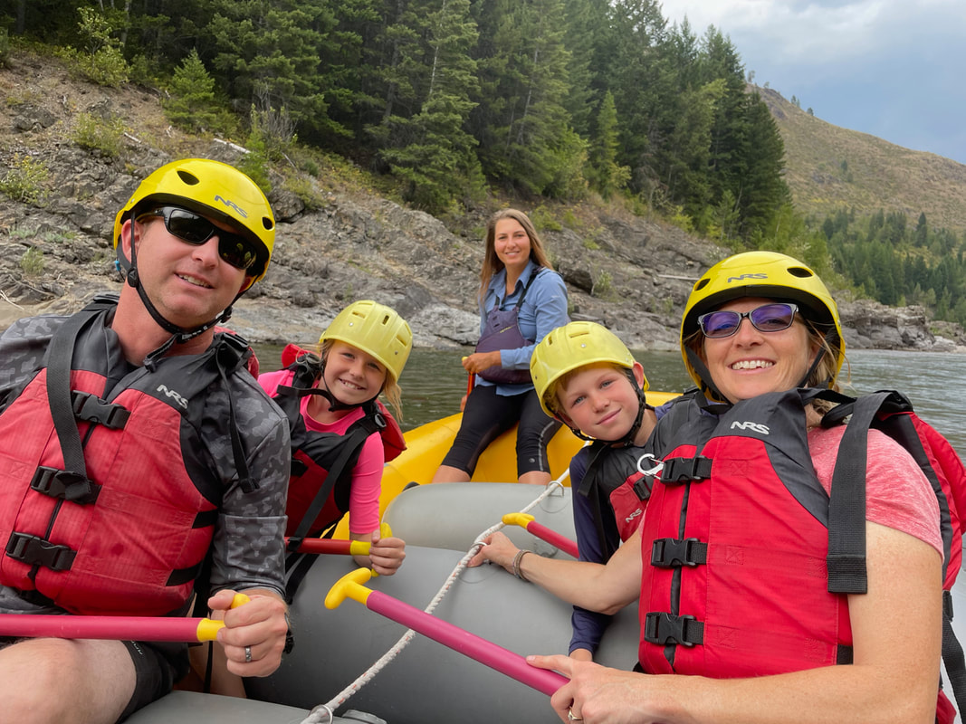
lay those purple mountains majesty that we've always sung about, with little white glaciers tucked between their ridges. We saw a mountain goat and finally got to see our black bear! Fact: Scientists predict that the glaciers at Glacier National Park will all be gone by 2030 if the warming trends continue. When seeing gorgeous views like this, it didn't take long for nature therapy to do its trick. After an elevation gain of 2200 ft, we reached the mountain summit, revealing Grinnell Glacier tucked between the peaks and the ice melt lake below . What. a. sight. I just had to stand there for a moment taking in the strange and peaceful views. The fog hung low, so we couldn't tell just how high the surrounding mountains were. As it turns out, we were so in awe of the view that we didn't take many pictures, not that it would do it any justice. 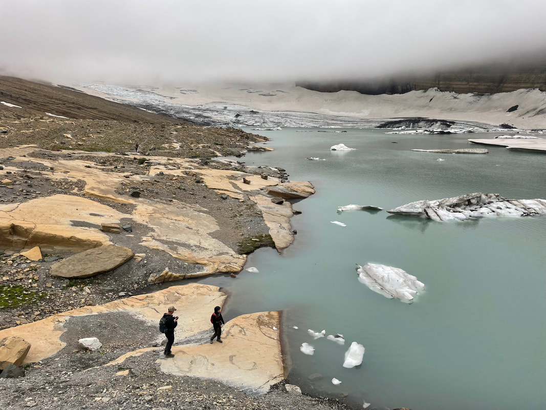
mountain. The views were just as beautiful seeing them from the other direction. Of all the hikes we've done, in all corners of the earth, this hike was my favorite. Absolutely stunning from start to finish. Tips for GlacierGlacier is absolutely beautiful and has a lot to offer, whether you prefer enjoying the views from a car or ferry or you're wanting to get into the backwoods and explore. If you have a chance to go, I highly recommend it. Due to the high volumes of visitors, we don't feel like we were able to make the best of our visit, so if you ever get to go, here are some recommendations. 1. Don't underestimate the crowds. Don't forget to get your pass on Recreation.gov to make life easier on you, but also don't think it will help thin the crowds that much. We went after Labor Day, hoping to miss summer crowds...but so did everyone else! We didn't have traffic, per se, but we couldn't find parking. Some people say they've actually been stuck in lines of traffic the whole way down GTTSR.
a pretty penny, but you'll be able to say you rode in a Red Jammer, which has been serving park visitors since 1936, and you'll have a personal tour guide.
3. Campgrounds are nicer in West Glacier, and the park campground is first come, first serve. Have an idea of what you'd like to see and do and plan accordingly based on where you're leaving from.. We wasted a lot of time driving back and forth. 4. Check the National Park Service website for trail closures. Glacier has the highest population of bears among the national parks, so they often close trails due to bear activity. 5. Part of the park is in Canada! Glacier is the world's first International Park, sharing territory with Canada, the U.S., and the Blackfeet Indian Reservation. We unfortunately didn't get to Canada, but if you go, bring a passport and check it out! 6. The best way to conclude your days at Glacier is with huckleberry ice cream at the Huckleberry Patch in Hungry Horse, just west of West Glacier. Here you will find anything you can possibly imagine made of huckleberries from jam to honey to gummy bears, pies, tea, coffee, BBQ sauce, and more. 7. Lastly, if you are physically capable, don't miss the Grinnell Glacier hike! If 11.6 miles is too much, consider purchasing tickets on the ferry to get you across Swiftcurrent and Josephine Lakes to cut at least 3.5 miles off. Either way you choose, you won't regret it! *Contains affiliate link Our Favorite Experiences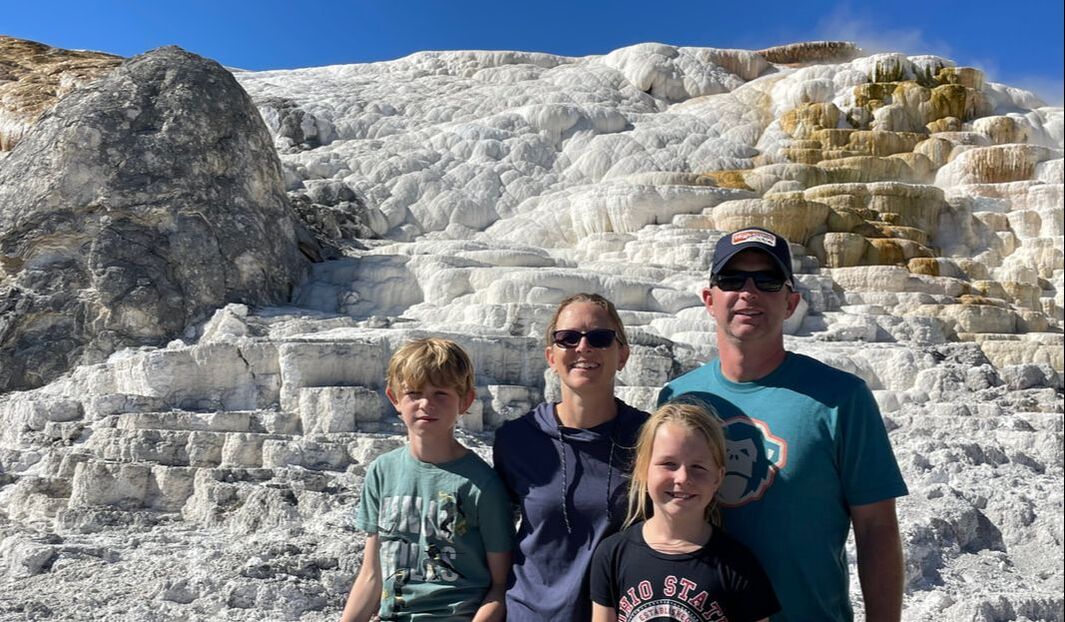 We hope you were able to read Yellowstone Part One, which set a foundation with fun facts about Yellowstone. Seeing these features in action, and in such huge abundance in a small area, is mind blowing, and truly some of the most beautiful and other worldly sights that our country has to offer. Compile that with once in a lifetime experiences and you have a perfect vacation! Artist's Point at Canyon Village
Midway and Lower Geyser BasinsIt was getting to be dinner time when we arrived at the trail to see the Grand Prismatic Spring. This is the one you see in all the Yellowstone advertisements, with vibrant colors of the rainbow ranging through the hot spring--deep blue in the center and spreading out to yellows, oranges, and reds on the edges. Arrival was a bit of a letdown. Not only was it so steamy that you couldn't see the colors, but being eye level with the huge spring was much less dramatic than the aerial views you see in photos. FOMO to the rescue! Dusty had read about a Prismatic Spring overlook you could hike to at the Fairy Falls trail head, the next stop on the loop map. We made sandwiches in the car and arrived to find the last parking spot in the lot--with a bison grazing just in front of the asphalt! By this time we had seen several male bison on the sides of roads and weren't too concerned about him. We parked, watched him graze two feet away from our front bumper while we ate dinner, and waited for him to move away so we could get out of the truck. Finally, he moved...right to the trail head, where he continued to munch on his dinner for another 20 minutes. By that time, two large groups of people were forming, waiting to enter and to leave the trail! The bison was not phased and continued his feast until he was ready to leave! Finally we were able to start our hike and got that good view of the vibrant hot springs from above! 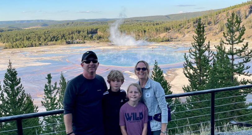 As we left the overlook trail, the sun was beginning to set. We arrived at the Lower Geyser basin to find an ambulance in the parking lot. Turns out another bison was moseying along the boardwalk and rangers had been called in for protection. Upon interviewing the rangers, they said they come mainly to monitor the people, not the bison. He escorted us and a small tour group to the boardwalk and it became increasingly clear why rangers are needed to monitor people. As the bison starred down the onlookers (clearly threatened), some old dude in a bright red sweatshirt turned his back to the bison and moved in closer for a photo op. SMH. Sometimes I just can't even begin to understand people. Eventually the ranger gave us the go ahead. This basin contained all four types of hydrothermal features, including mud pots, hot springs, fumaroles, and geysers, so we went forth! We were admiring how cool the Red Spouter fumarole was when suddenly the Fountain Geyser started going off. This geyser typically erupts every 4-7 hours, so being there when it went off was purely by chance. Even more amazingly, the bright orange ball of the setting sun lined up perfectly with the exploding water and steam so it looked almost like a roaring fire blazing out of the earth. The eruption continued for about twenty full minutes, and two other geysers, which must share the same plumbing system, danced along with the Fountain. Talk about a show! We couldn't have asked for a more perfect way to end our day! Two close encounters with two bison and a water works show just for us! Wow... The next morning, we left the house totally exhausted from the day before, but afraid we would miss out on any level of excitement if we didn't get up with the animals. As it turned out, all the animals were on vacation on Monday--all day-- so we didn't see anything except one bison on the side of the road early in the morning and a few more way out in a field later that day, as well as a few pronghorns. Sheepeater CliffAn hour and a half into our drive, we stopped for a short hike at Sheepeater Cliff. Basalt columns formed by slowly cooling lava flows created these cliffs millions of years ago. Clearly, the rocks were calling my family's name, so all three of my children decided they needed to conquer the cliff. I stood by at the bottom in case I needed to seek medical attention, but as it turned out, they all did great reaching the top, and making it down safely. Their Guardian Angels have their work cut out for them, but I'm so glad they are such steadfast protectors! Swimming at Firehole Canyon
Eating OutI can't finish this post without mentioning the food in West Yellowstone. There is a great new burger place called T.R.'s Burgers. The burgers were pretty o.k., but the fried cheese curds with huckleberry sauce was to die for. Not only that, but the restaurant is dedicated to Teddy Roosevelt, complete with a slideshow playing on a big screen with tons of fun facts and photographs about Teddy's life. The history nut in me was going ballistic! The Espresso and Ice Cream House has delicious ice cream AND bubble waffle cones that make for the best treat after a long day, and the staff is so sweet. Dusty highly recommends the huckleberry ice cream, a tradition for this area of the west! We also recommend Wild West Pizzeria and Saloon for delectable wood-fired pizza (the best I've had in a long time!) If you take your children, though, be prepared to explain why the bathroom doors are labeled "pistols" and "holsters." Grizzly and Wolf Discovery Center
This post is getting long, and to us, this just seems to be the tip of the iceberg for such a fun-packed two and a half days. Yellowstone is truly a wonderland and a place everyone should see if you can make it happen. Our advice: stay longer if you can. Take two days to really enjoy the lower loop. The upper loop isn't nearly as exciting, so if you only make it to Mammoth Hot Springs, that's ok. (Side note: the upper loop was fully open after the record breaking spring floods, however, the north entrance is closed and the road through the Lamar Valley was only partially open to a limited number of people who reserved tickets on recreation.gov. If you intend to go anytime soon, be sure to check the closure statuses.) Final advice: let your FOMO take control and get to Yellowstone!
*Contains affiliate link 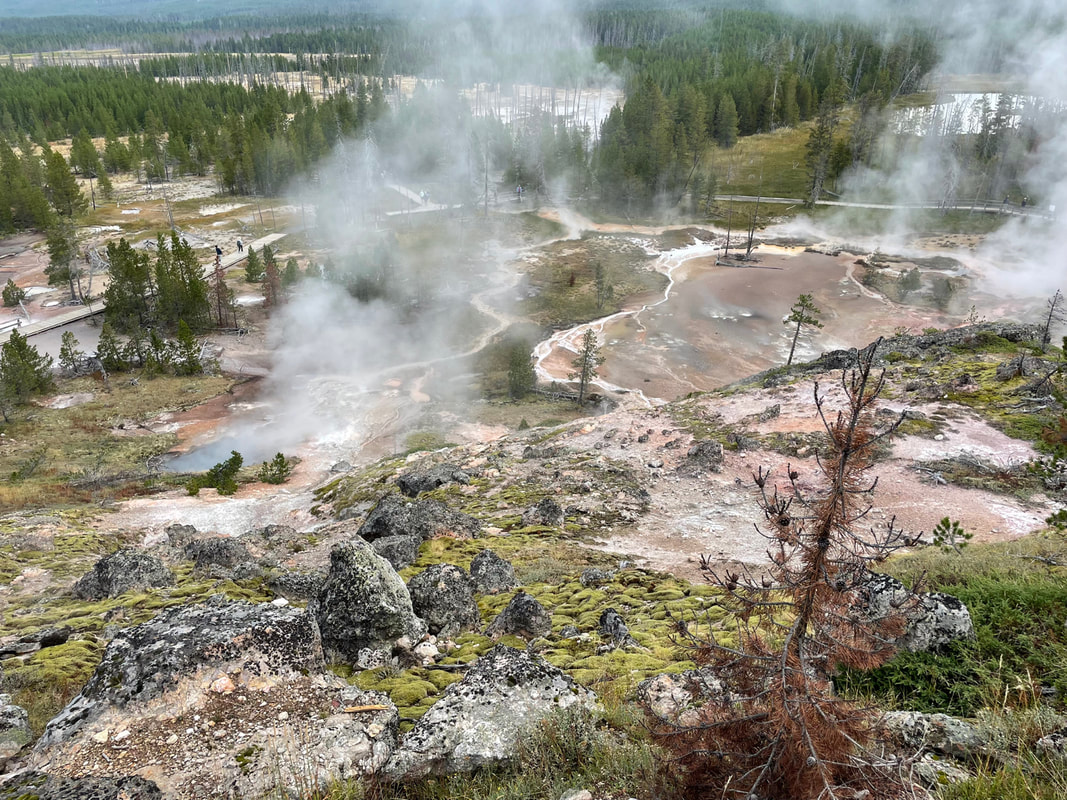 How much of Yellowstone can you explore in two and a half days? That depends on whether or not your husband has a serious case of FOMO (Fear of Missing Out) and how much your family allows you to squeeze into day light. Turns out, since our kids are AWESOME (and my husband has the biggest case of FOMO you could imagine), you can experience pretty darn close to all the Grand Loop features. Yellowstone became the world's first national park when Ulysses S. Grant signed a law setting the land aside for "the enjoyment of the people" in 1872. We've always known Yellowstone was special, but none of us were prepared for the geological wonderland that lay before our eyes. Fortunately, we had our trusty GyPSy Guide* to lead us through, explaining geologic features, the park's history, the struggles in bringing back bison and wolves, and, of course, all the best sights that were not to be missed. (We purchased this app for Grand Teton NP as well, and absolutely loved having a guide to the park. Not only do we highly recommend this app, we wouldn't dream of doing this park without it.)
Our first day at Yellowstone, we woke up before the sun, spent 14 hours experiencing the south loop, hiked 14.3 miles, and managed to "do" all the things recommended by our GyPSy guide. I'm still not sure how we managed, but it involved not stopping to eat and very few bathroom breaks! Monday we were on the road by 7 and got home at about 6:30, having an enjoyable day on the north loop. I don't have time to tell you everything we did, so I'll humor you with some fun facts, then share some of our favorite experiences. Fun Facts--There are over 500 geysers in Yellowstone; that's over half of the world's geysers. We've seen geysers in Iceland that erupt quickly and then the show is over, but many of Yellowstone's geysers erupt for a long period of time. Old Faithful usually erupts for 3-5 minutes, the Fountain Geyser erupts for about 20 minutes each time, and there are some geysers in the park that erupt continuously.
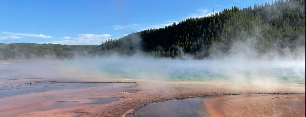 --Back in 2020, when we were all expecting the end of the world, I read an article about a super volcano at Yellowstone that could theoretically erupt and take out most of the United States. I never gave two thoughts about it until I saw this huge pink area (35 miles by 40 miles) on the Yellowstone map that read "approximate caldera boundary." Knowing that a caldera is a crater left by an erupting volcano, my curiosity was peaked. Turns out, there was a HUGE volcanic explosion 2.1 millions years ago, followed by two others that all make the 1980 Mt. St. Helens eruption seem like a blip on the seismic radar. In fact, Yellowstone is still considered an active volcano, given all the hydrothermal and seismic activity in the park. --Speaking of seismic activity, Yellowstone experiences mini-earthquakes every day. These work in two ways: 1. They shake mineral build-up out of vents, allowing geysers, fumaroles, and other features to keep working, or 2. they block vents, open new vents, or otherwise reroute vents so that the hydrothermal features are constantly changing. --Wildlife is abundant at Yellowstone. The park is famous for its rehabilitation of the wolf population. Before our understanding of complex ecosystems, wolves were often shot on sight. The wolf is an important predatory animal that's needed to help control other species' populations. For decades, there was no evidence of wolves in the greater Yellowstone area. The elk population expanded, and as they ate much of the willow and other grasses, other species populations, such as beaver, began to dwindle, creating an imbalance in the ecosystem. In 1995, wolf packs were reintroduced to Yellowstone and biologists have been surprised by new animal activity that hasn't been seen here for a long time. We didn't get to see any wolves, however, we were lucky to see several elk and quite a few bison along the side of the roads. And even though we were fully prepared with bear spray, we didn't see any of those either. This post is getting quite long. I hope you got yourself some good edumacation about Yellowstone in Part 1 of the two part series. Tune in later as we discuss our favorite experiences in Yellowstone.
Have you ever been to Yellowstone? What were your favorite experiences? *Contains affiliate link 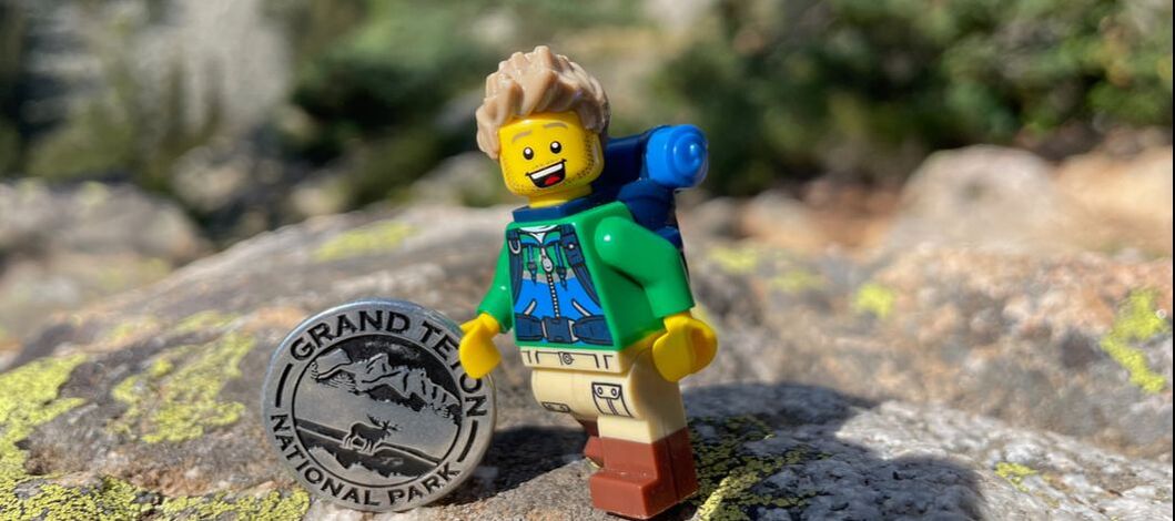 Upon leaving Dubois, Wyoming, where we spent two nights recuperating from COVID, a shopkeeper told us we didn't want to go to Jackson. "That's not Wyoming," she said. Now, I know that every year hundreds of thousands of tourists come to Jackson Hole and describe it as one of the best vacations they've ever had, even returning repeatedly for the experience. After three days there though, I'm inclined to agree with the Dubois shopkeeper. In the 1920's and 30's John D. Rockefeller, Jr. bought up thousands of acres of land around Jackson Hole with the intention to donate it to the government to expand the boundaries of Grand Teton National Park, protecting it from over-commercialism. It took some time for locals to get on board with the donation, and in fact, the acceptance of the property was debated and declined by congress for over a decade. Finally, Franklin D. Roosevelt accepted the property with an executive order in the 1940's and the locals accepted their fate, turning to tourism to make a profit. Today we have Rockefeller to thank for the pristine beauty of the National Park. We have big money, capitalism, and greed to thank for what has become of the city of Jackson and the state of the art skiing facility of Teton Village. What makes Grand Teton National Park so special can be traced back to the geologic formation of the place. (Have I mentioned how cool geology is yet?) As two tectonic plates collided, one slipped under the other, pushing an abrupt mountain range into the sky. During the last ice age, glaciers eroded the mountains and formed the valleys and lakes we see today. But the most dramatic view is the level prairie that gives way to the majestic Grand Tetons. 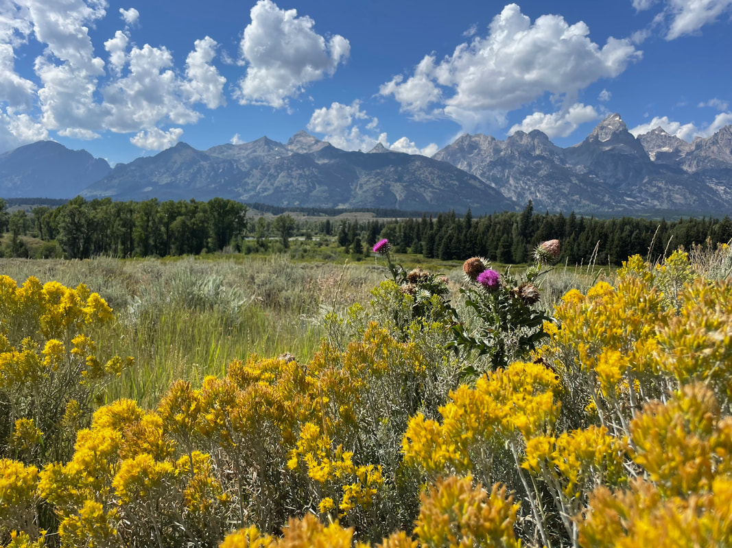 We started off our first full day with an early wake up to hit the trail around Jenny Lake, formed by glaciers some two million years ago. The day before, Dusty and the kids had been to the Visitor's Center to find all the parking lots full and cars lining the streets for about a mile. By arriving at 7:30 a.m., we beat the crowds, though certainly weren't the only people on the trail. We admired the scenery around the fairly flat border of the lake, then began our ascent to Hidden Falls and Inspiration Point at 7,200 ft. The views were spectacular and the chipmunks were photogenic. All of our bodies hadn't fully recuperated from COVID, so it was evident that the 9.5 mile trek around the lake wasn't going to happen. We paid $44 for a 4 minute trip on a full ferry back across the lake (which I'm still quite bitter about.) We purchased the GyPSy Guide* app for Grand Teton and Yellowstone. The GPS-navigated audio guide tracks exactly where you are in the park and is like a ranger right there in your vehicle! We learned about the history, geology, animals and environment, and best places to stop for views, hikes, or finding moose, bears, or elk. We highly recommend this app for anyone traveling our country's national parks. The GyPSy app guided us through some beautiful back roads and recommended some interesting stops along our park loop drive, which lasted for the rest of the day. We saw a few moose, a herd of elk, lots of antelope, and...chipmunks! During the winter, we are told that some 20-30,000 elk move into Jackson Hole (the valley). Traditionally, elk would pass right through the Hole because winters there are just too difficult and food is not plentiful enough to feed them. As settlers came in, putting up fences for cattle, they essentially trapped the elk inside. In the early 1900's, during a particularly rough winter, thousands of elk died of starvation. Settlers began feeding them, a tradition that continues to this day in an area known as the National Elk Refuge. Visitors cannot take home elk antlers they may find at the park. However, you can purchase found elk antlers for $179 at one of the local gift shops in Jackson.
There just aren't many RV parks in the area, hence the supply and demand price gouging that occurs at The Virginian. But it doesn't end there. Everything is more expensive in Jackson. So...I don't recommend activities in Jackson. I don't recommend the ice cream in Jackson (Banana actually had to throw her overpriced ice cream away because it was nasty). I don't recommend dining out in Jackson. Unless you are a millionaire and not frugal like me, or if you are celebrating a special event that you don't mind throwing all your money away on. Personally, I decided I'm never going back.
I'll be honest with you. I've written this post three times and it always sounded like a lot of complaining. Staying in Jackson was my own personal kind of hell, and my mood reflected that. However, Dusty loved the Tetons, so he would recommend the park. Just stay somewhere else. The Tetons are beautiful. There are a lot of people. Jackson costs a lot of money. *Contains affiliate link 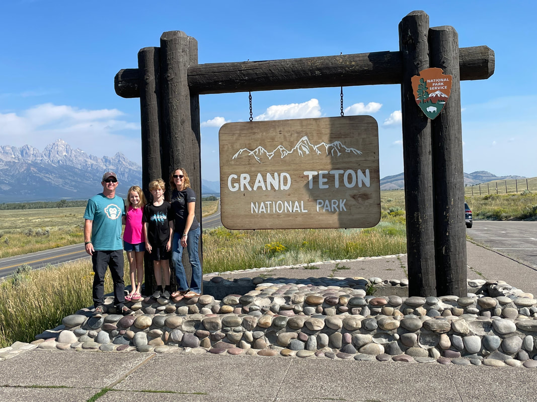 |
Archives
October 2022
Categories
All
|
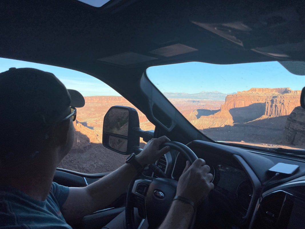
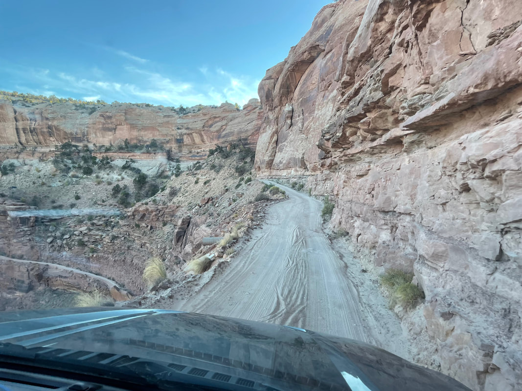
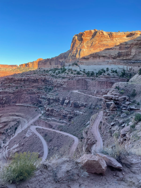
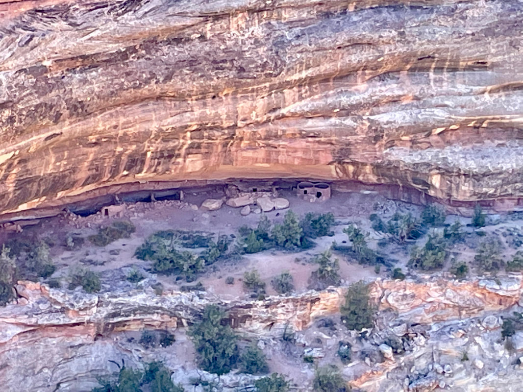
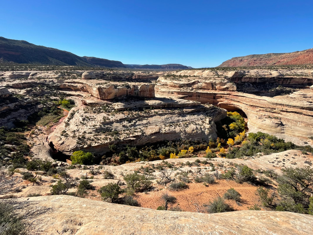
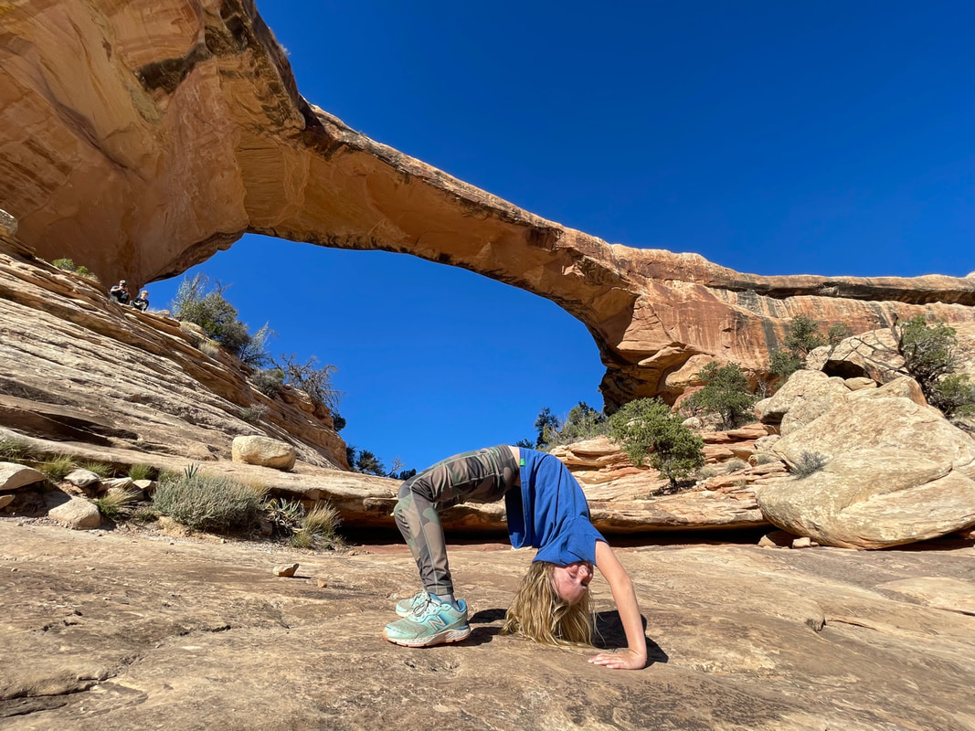
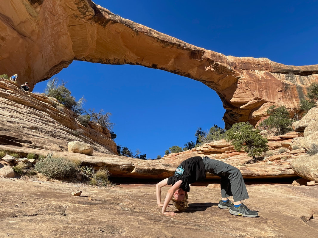
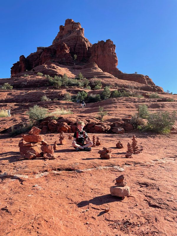
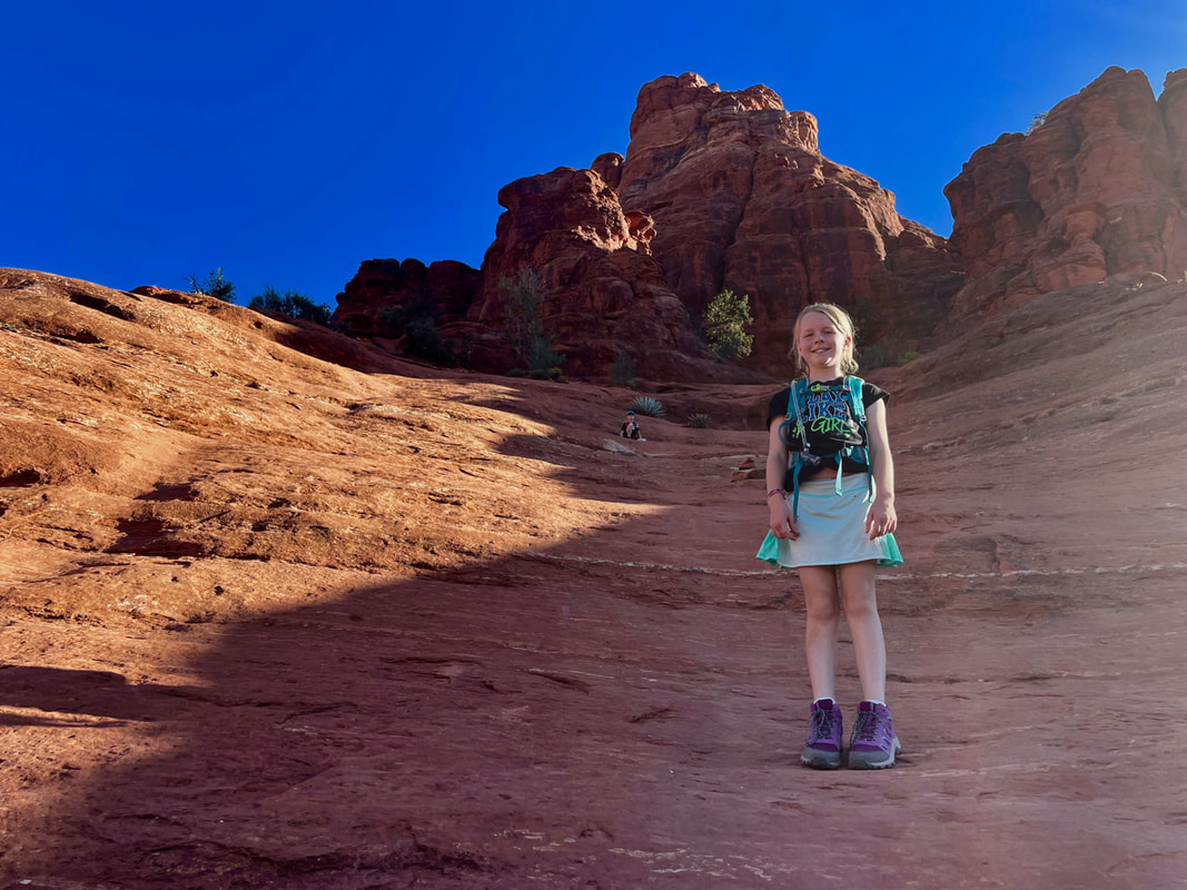
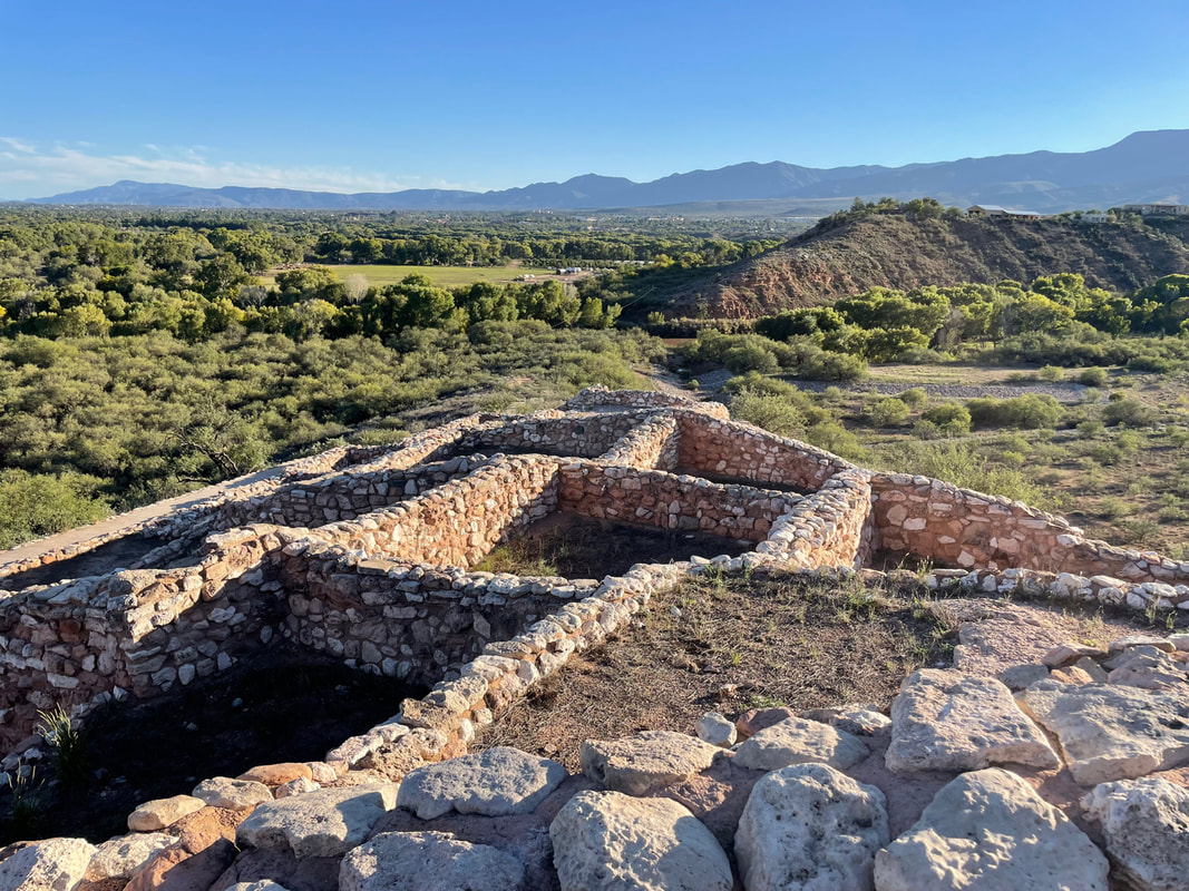
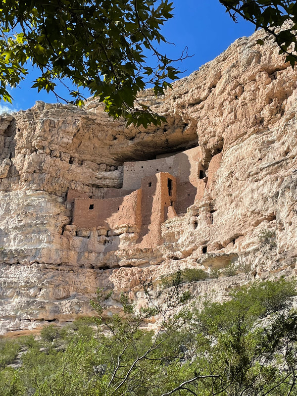
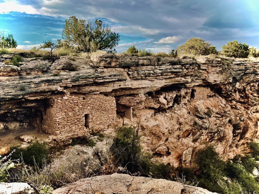
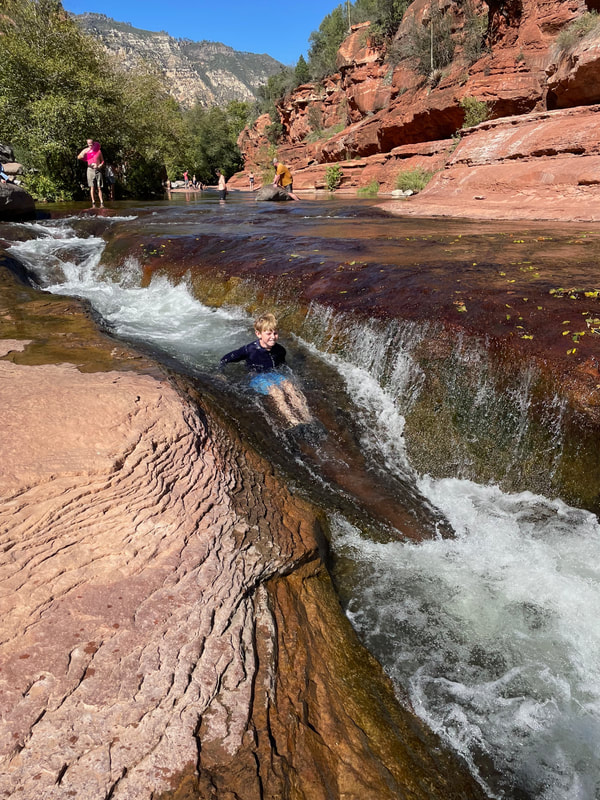
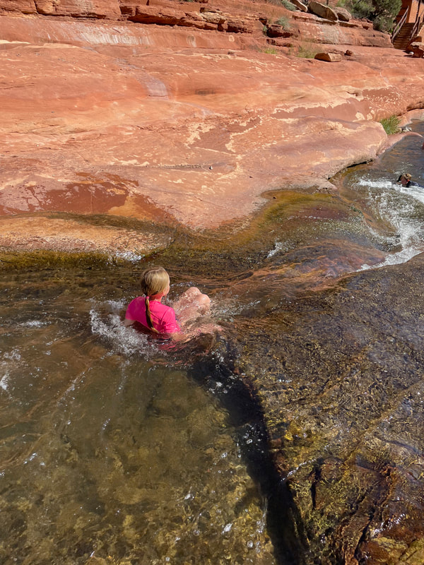
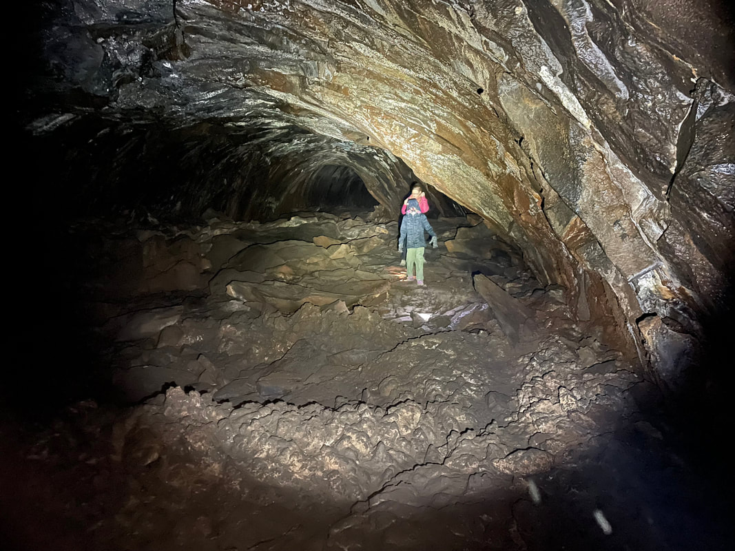
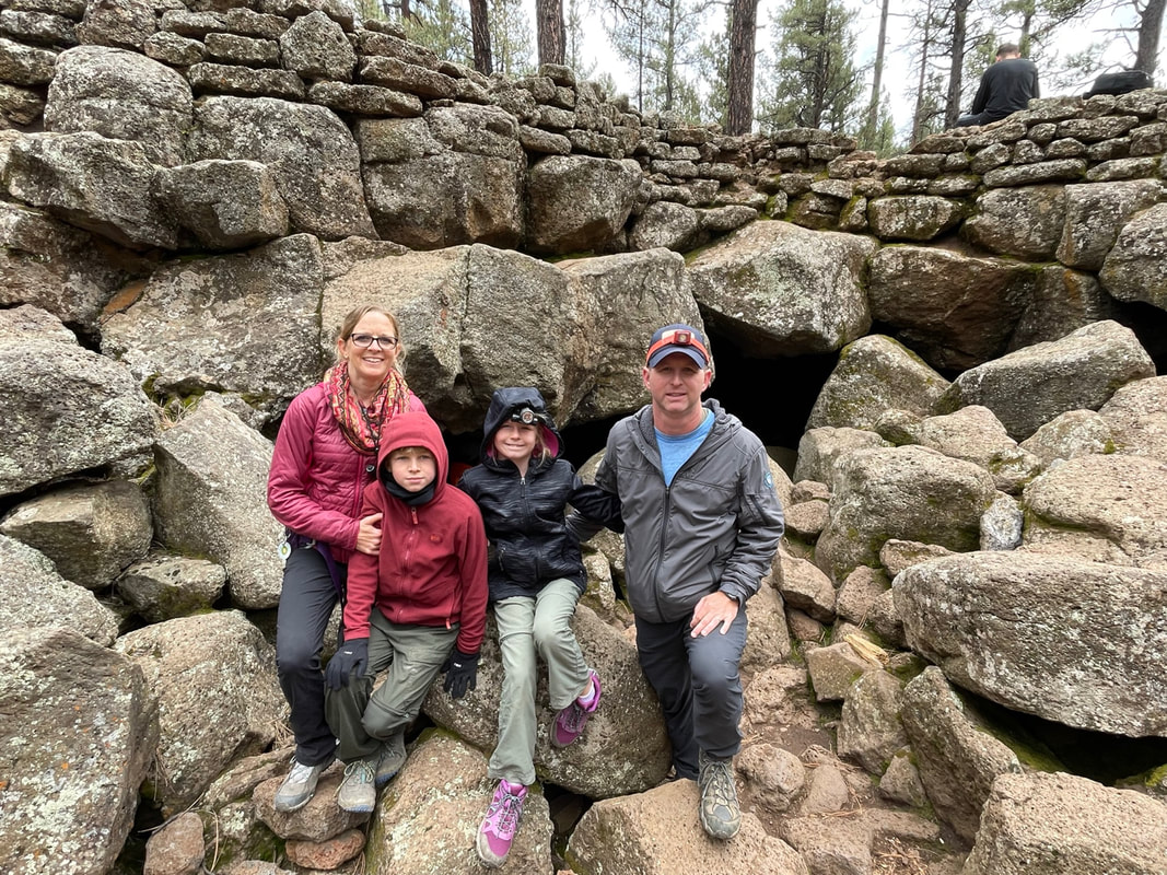
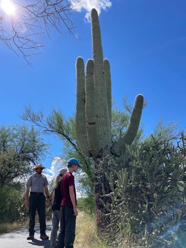
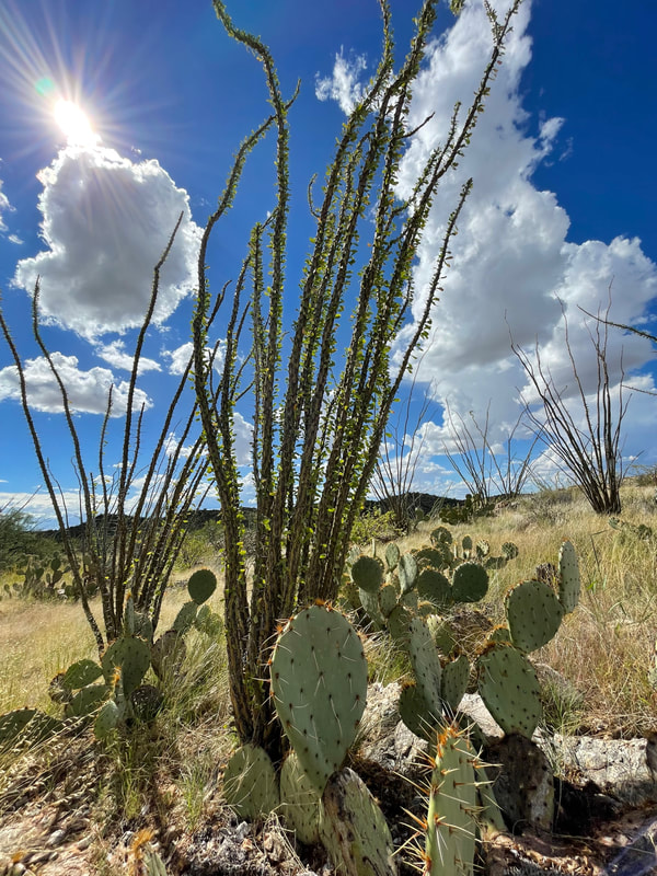
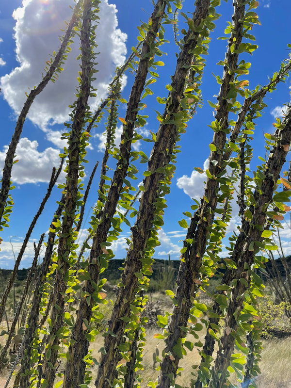
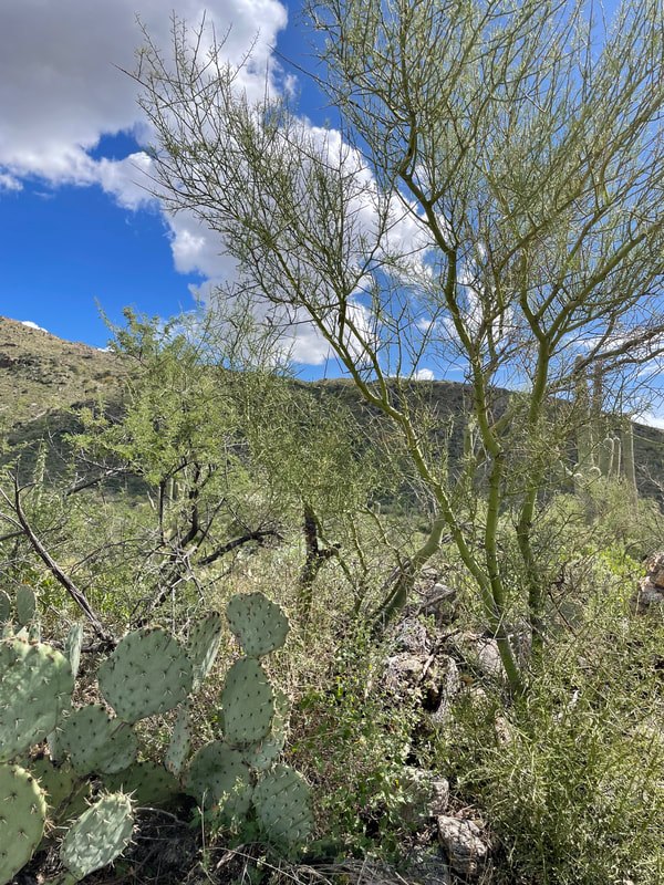
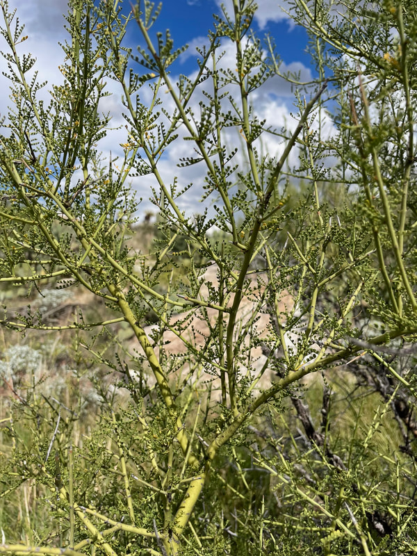
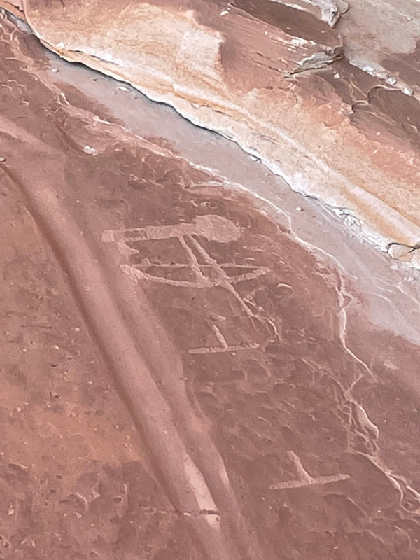
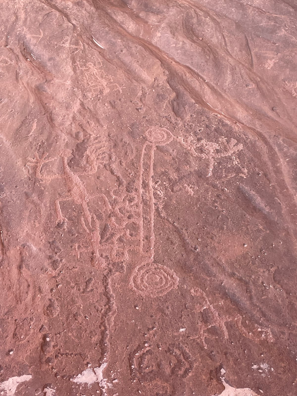

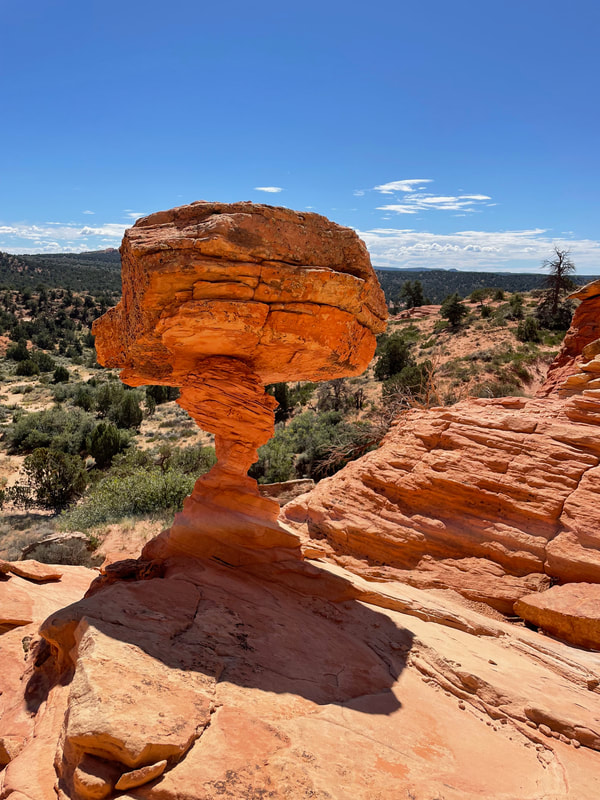
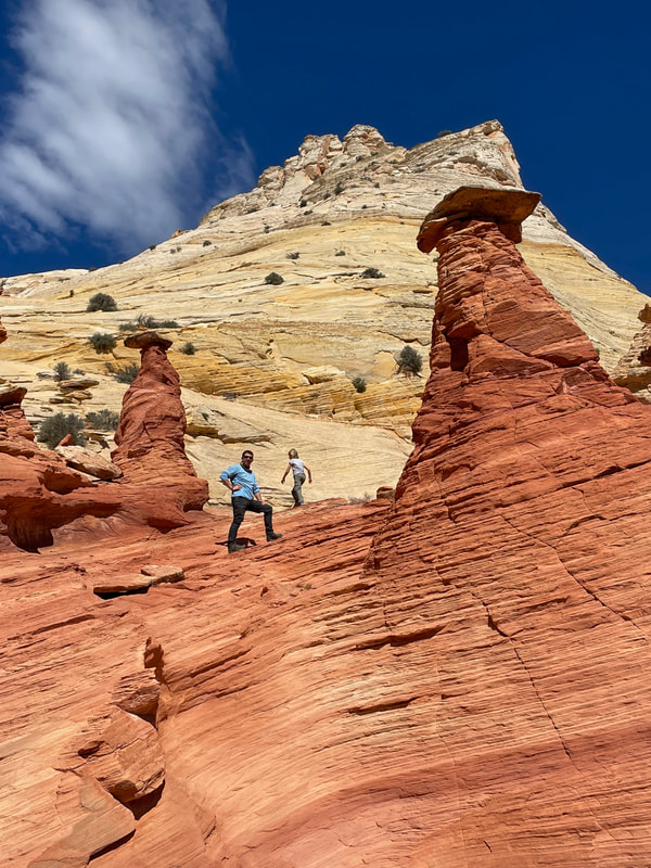
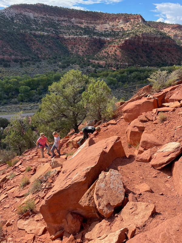
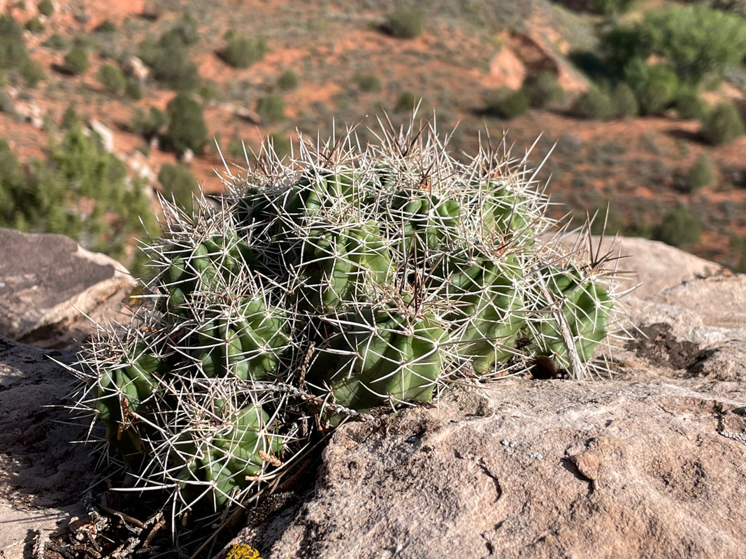
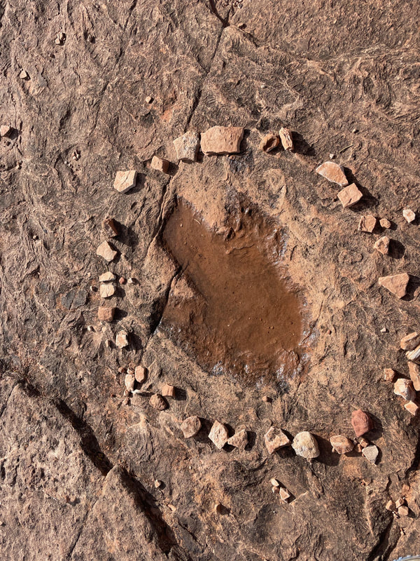
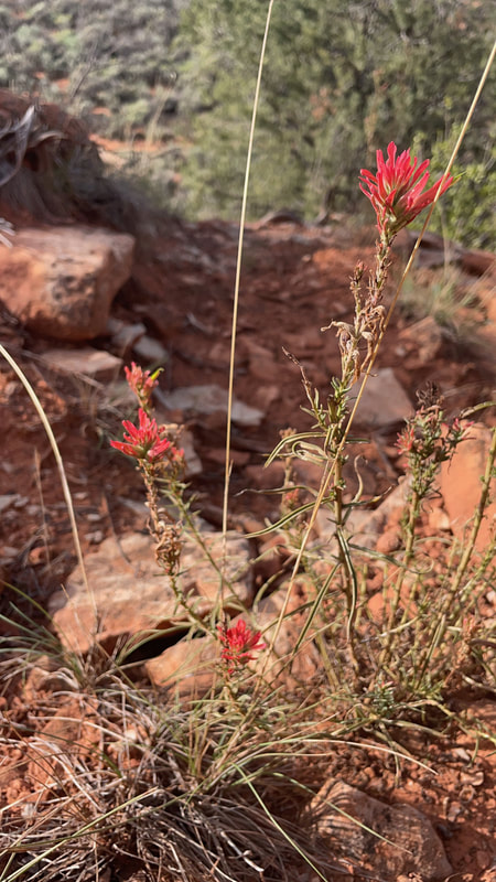
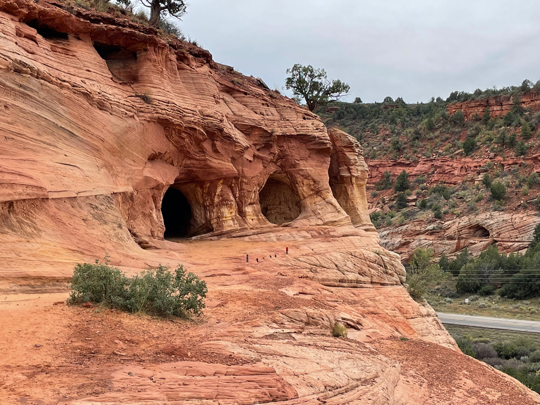
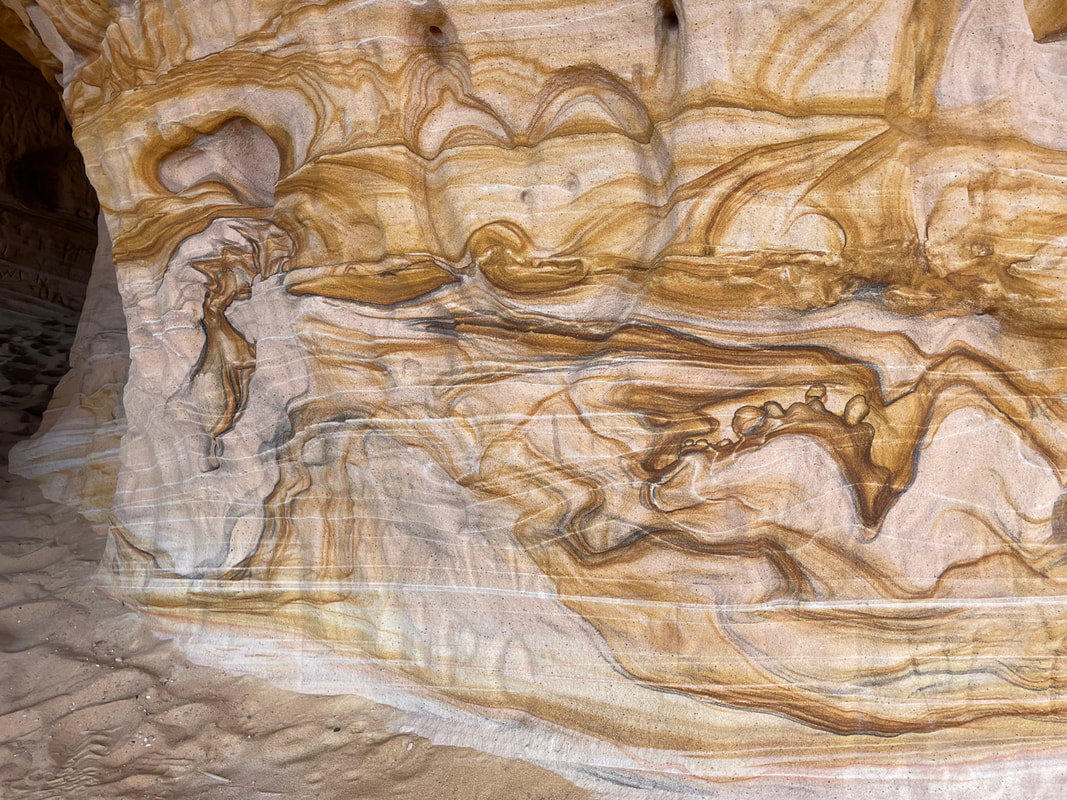
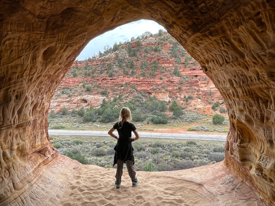
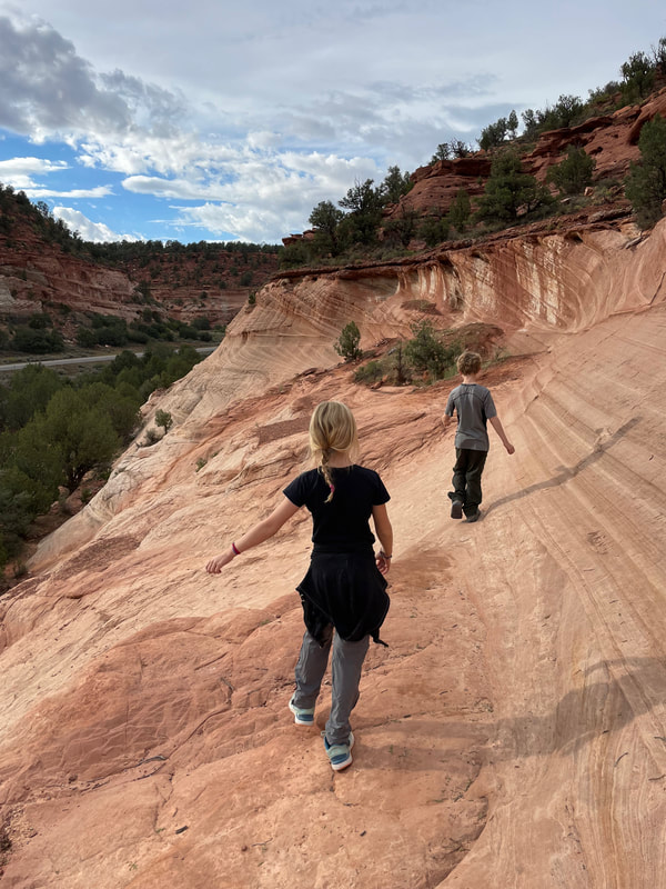
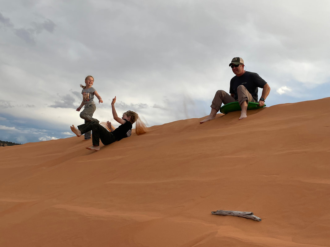
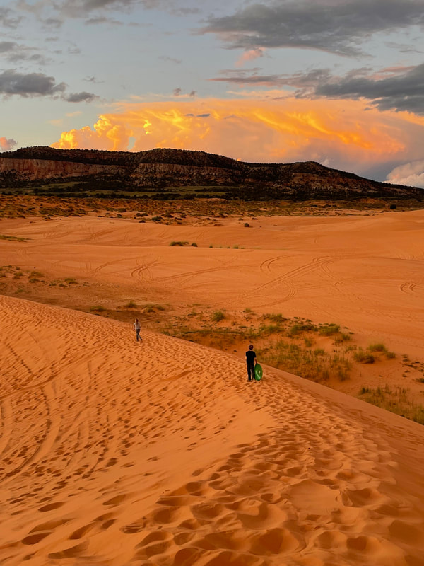
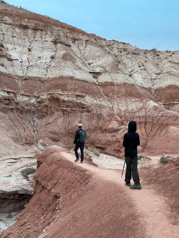
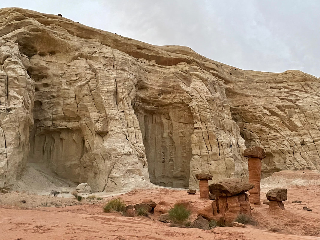
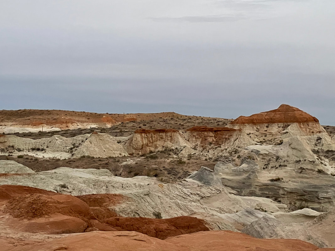
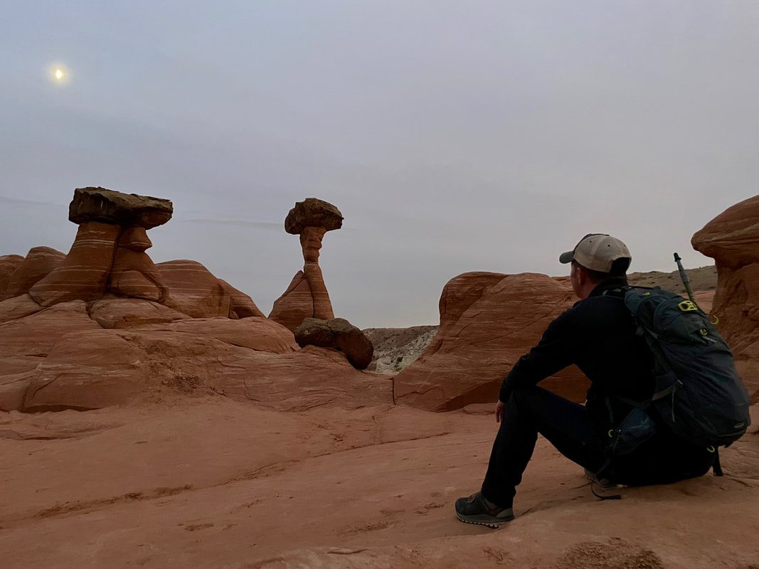
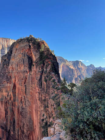
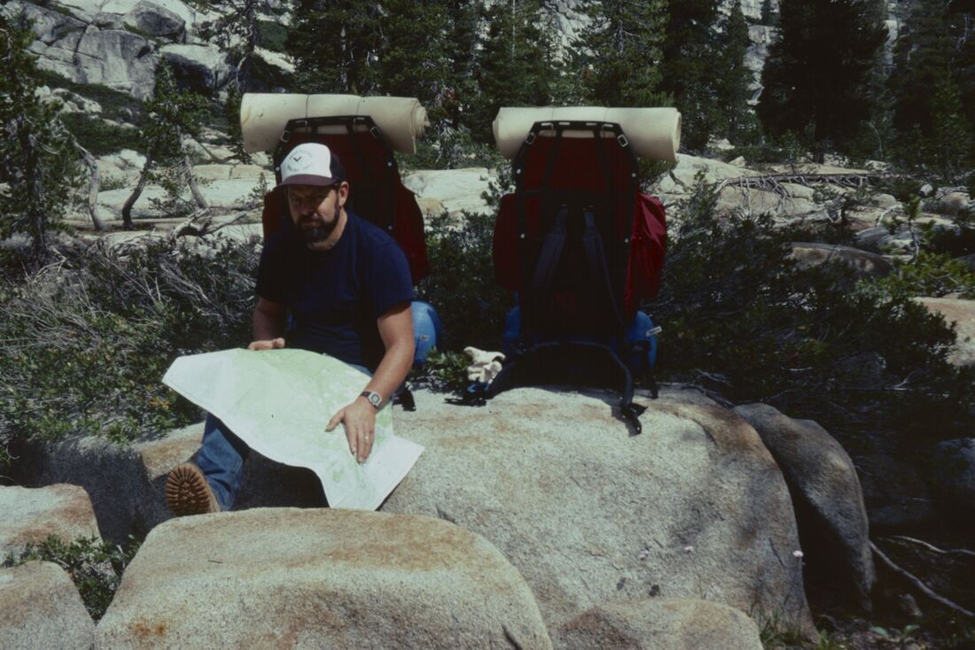
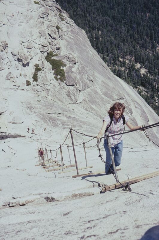
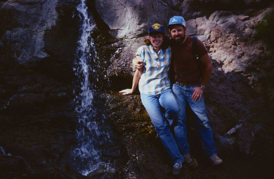
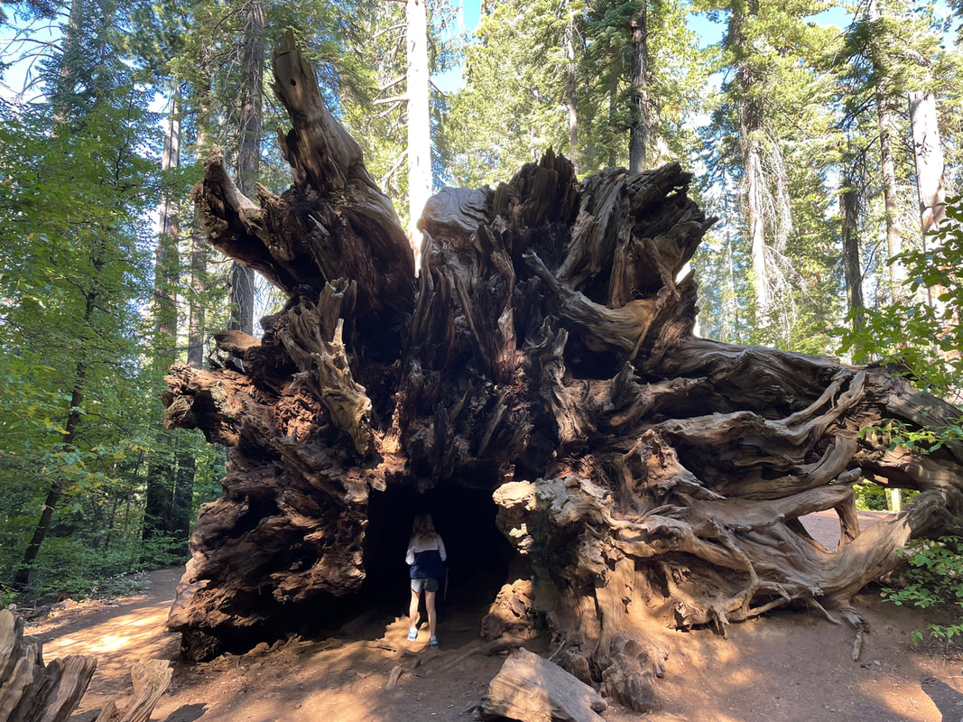

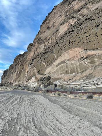
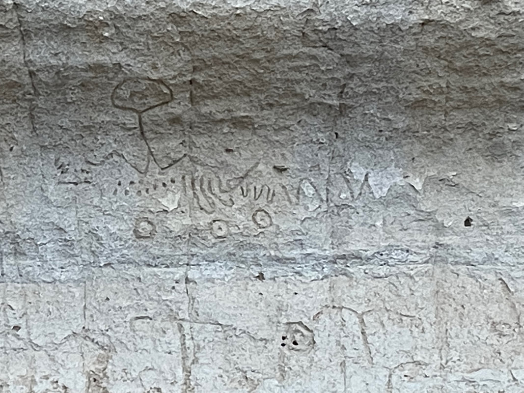
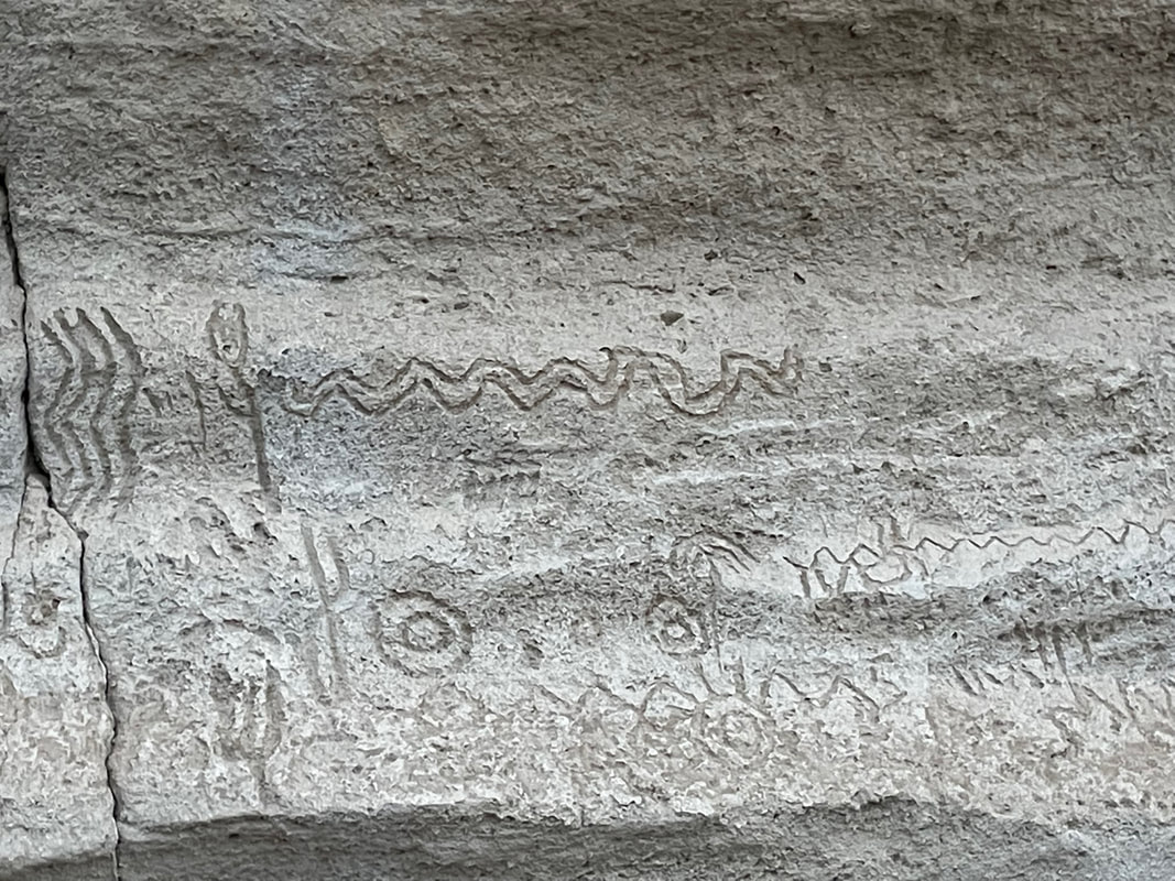
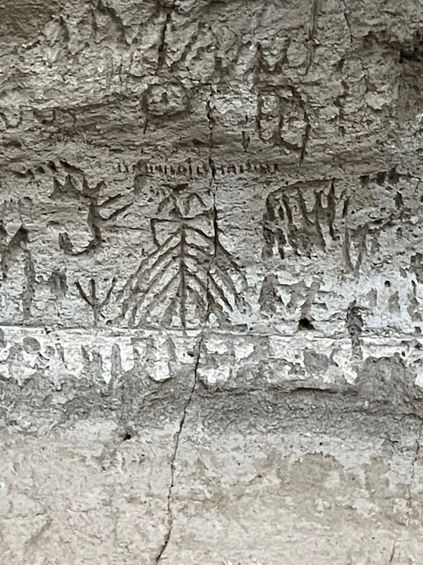
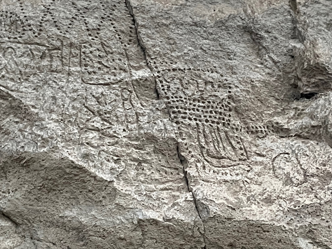
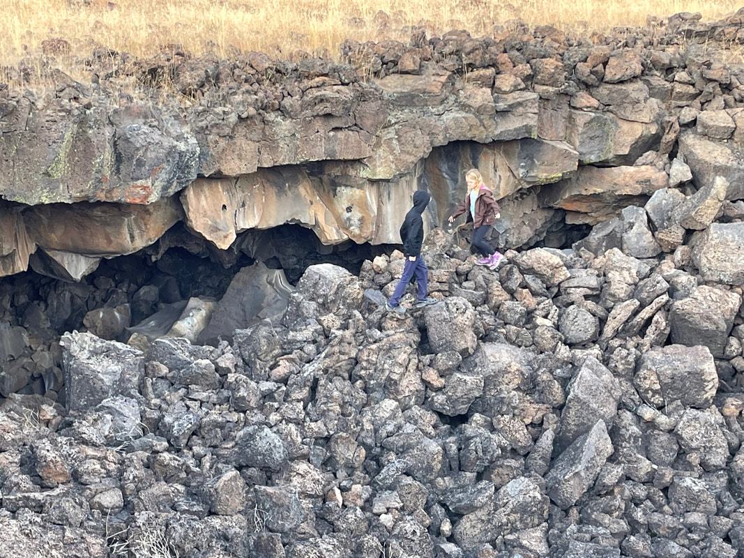
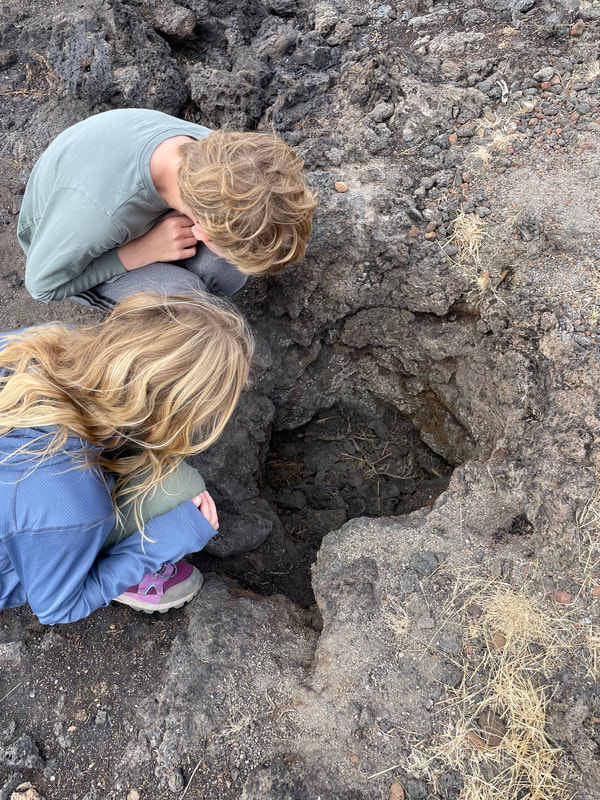
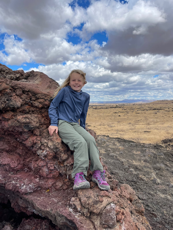
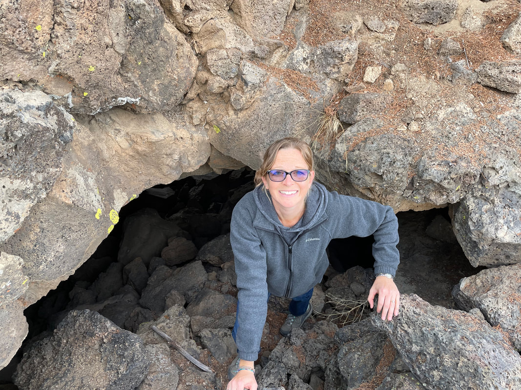
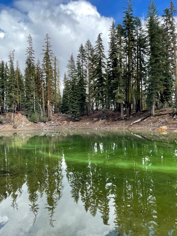
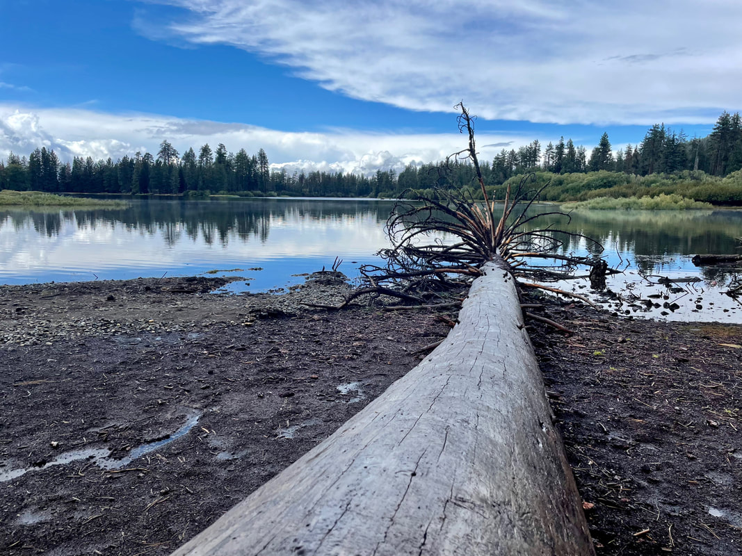
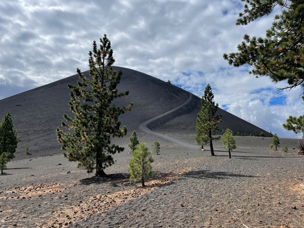
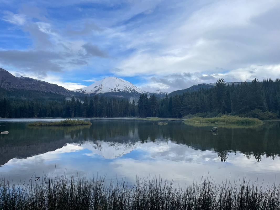
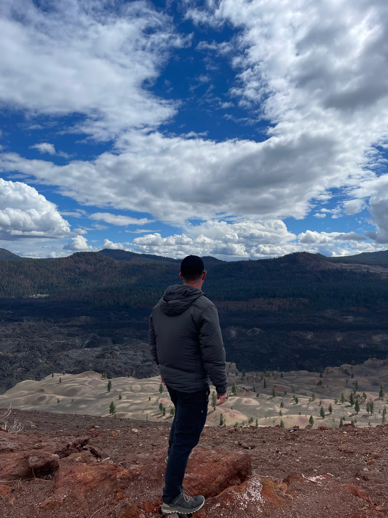
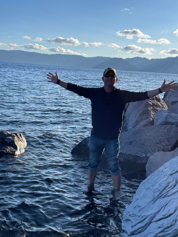
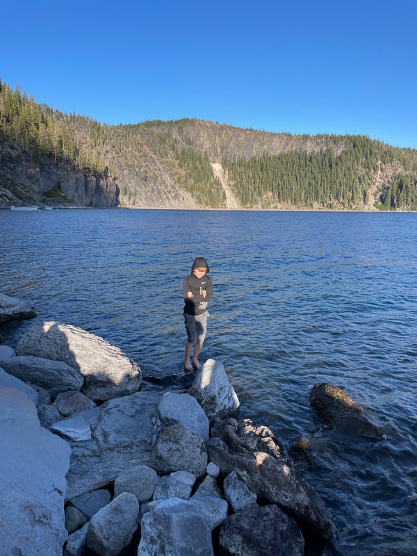
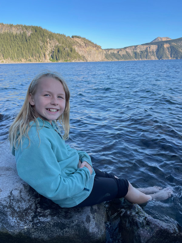
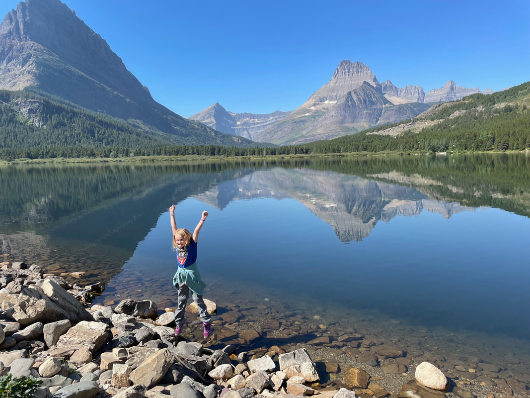
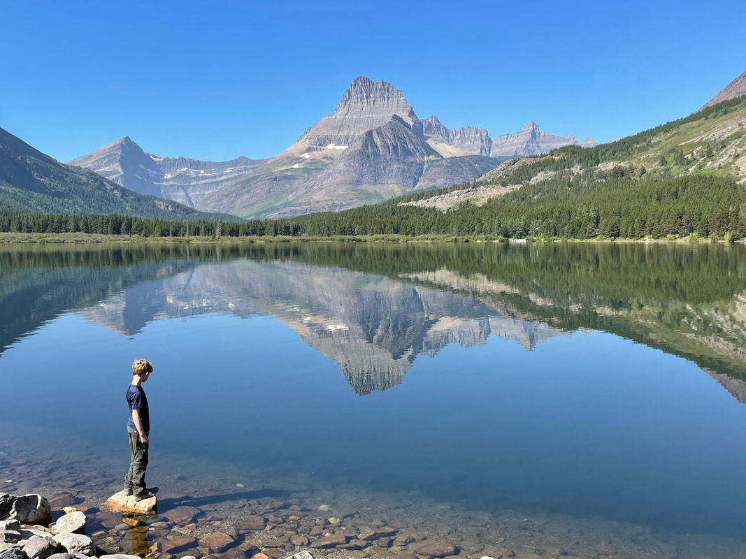
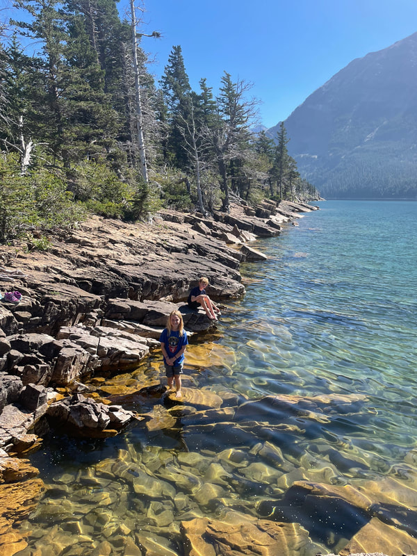
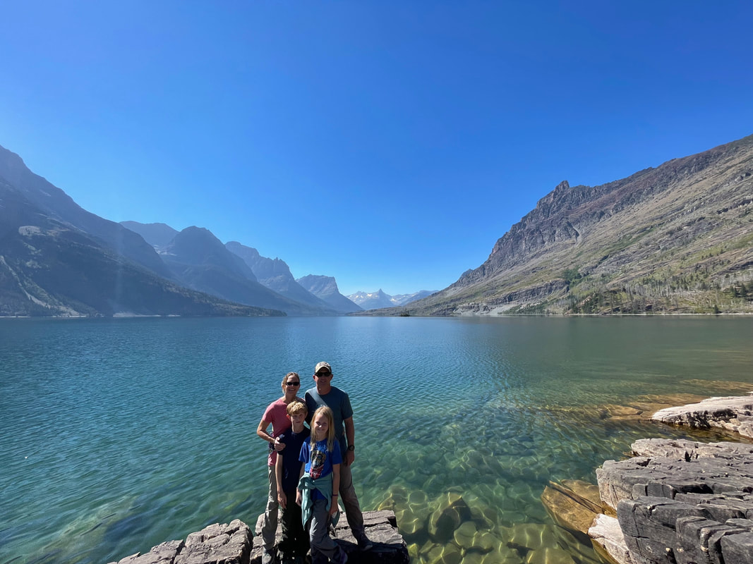
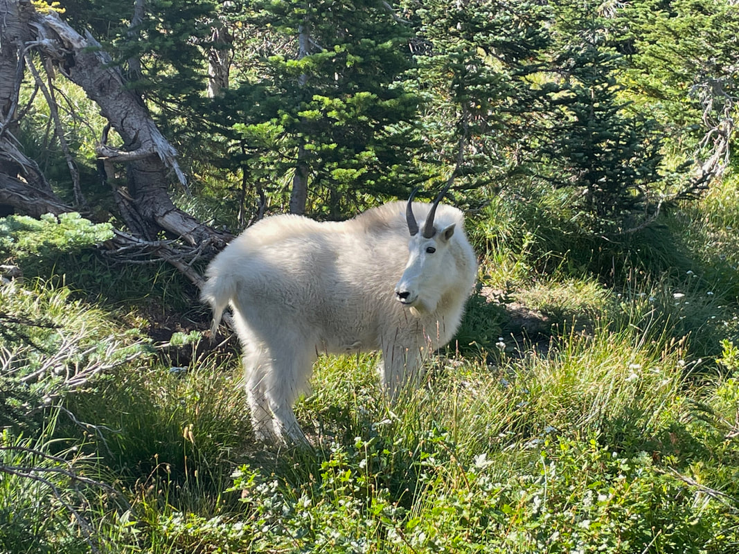
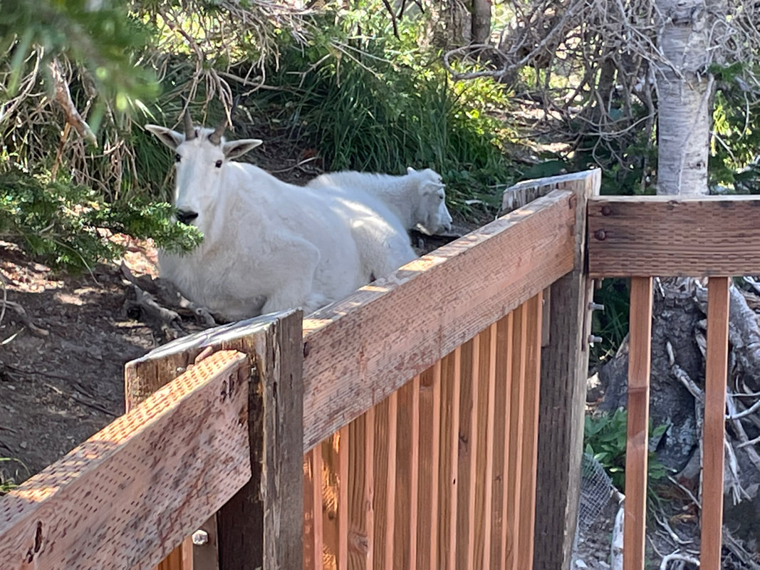
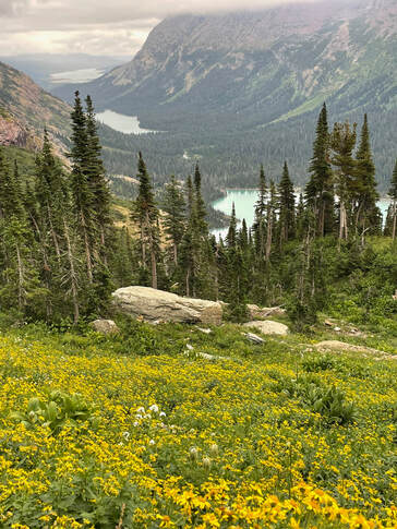
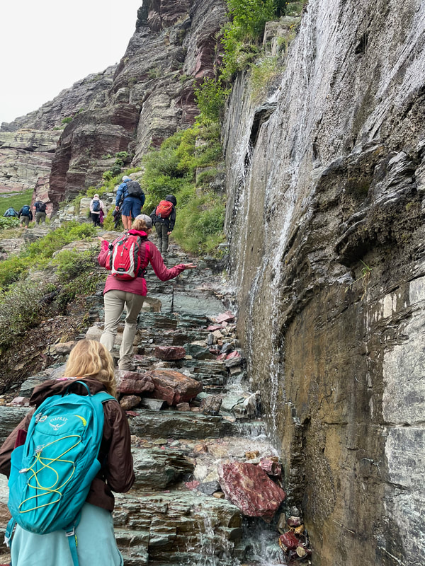
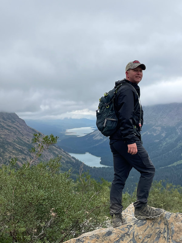
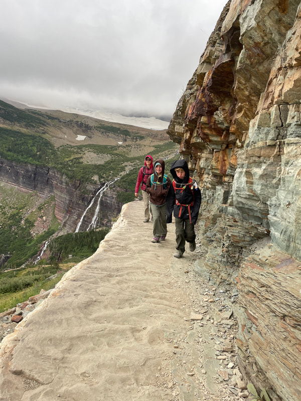
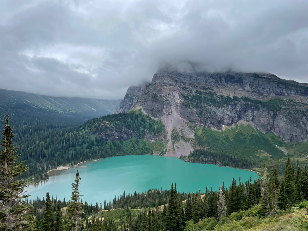
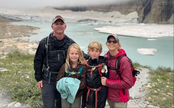
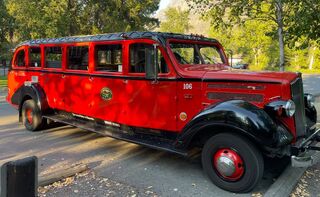
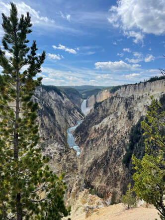
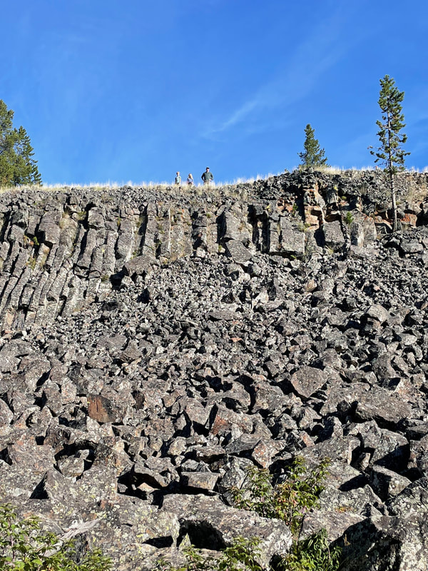
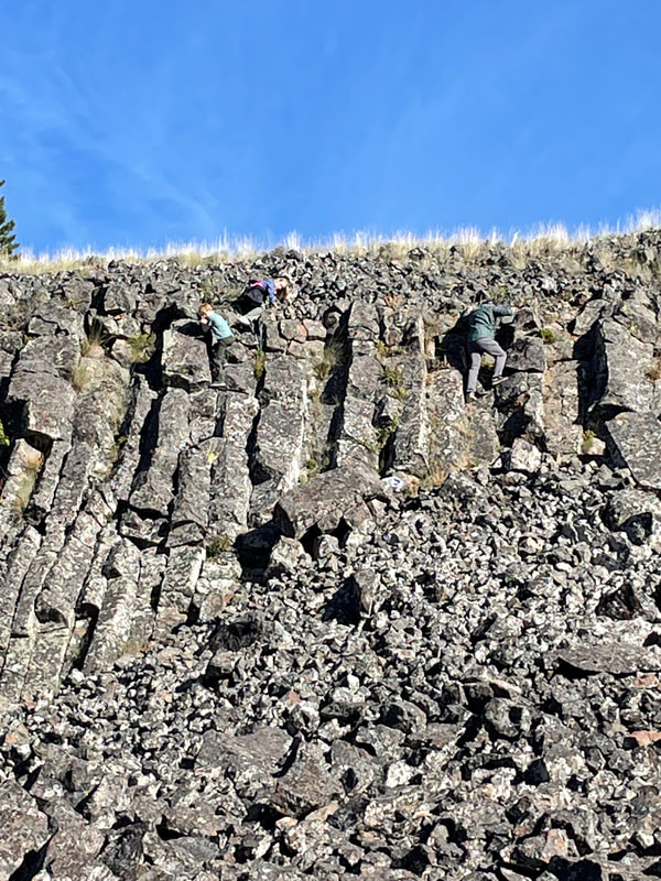
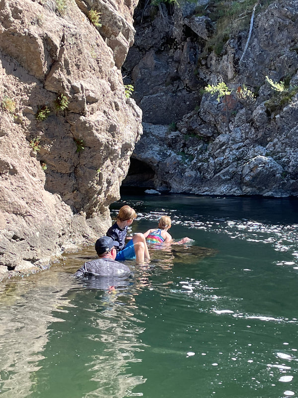
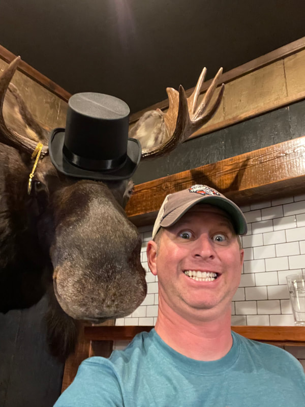
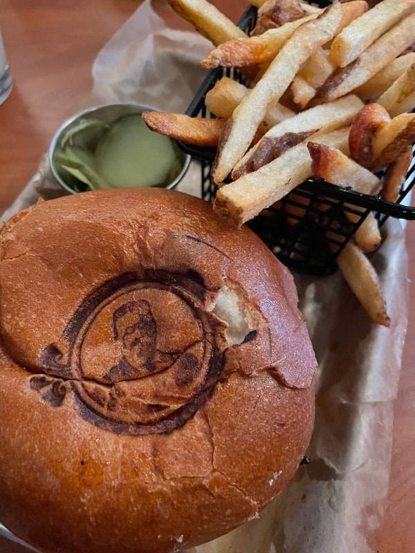
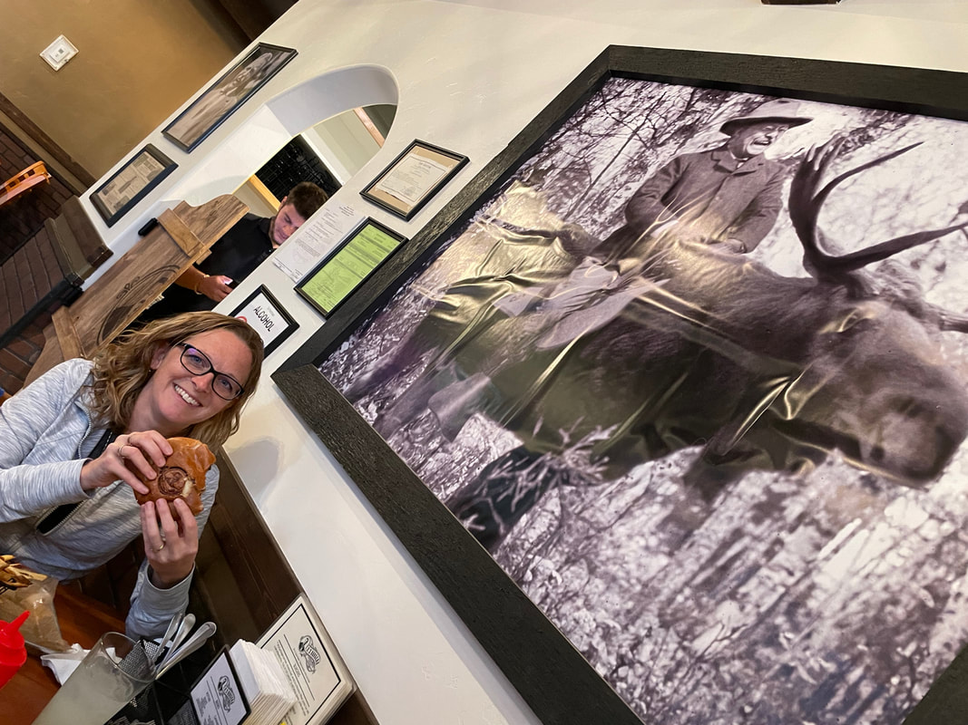
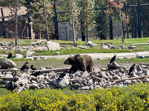
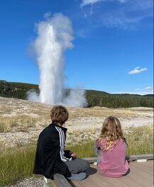

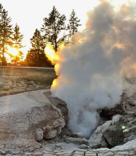
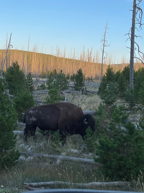
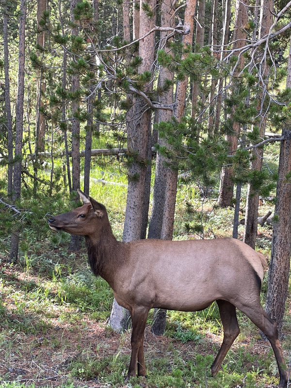
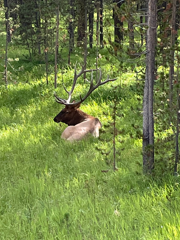
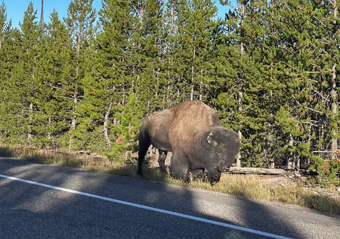
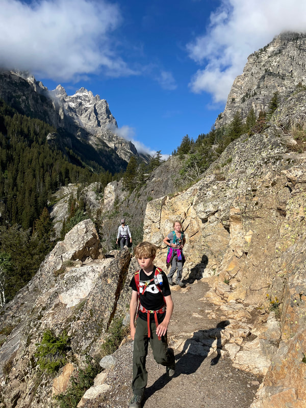
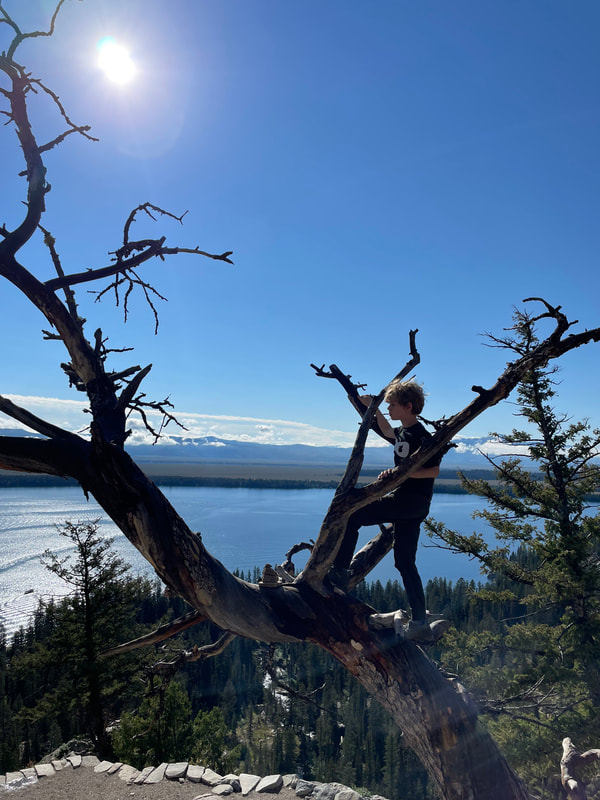
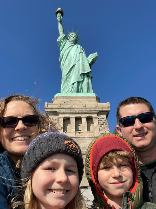

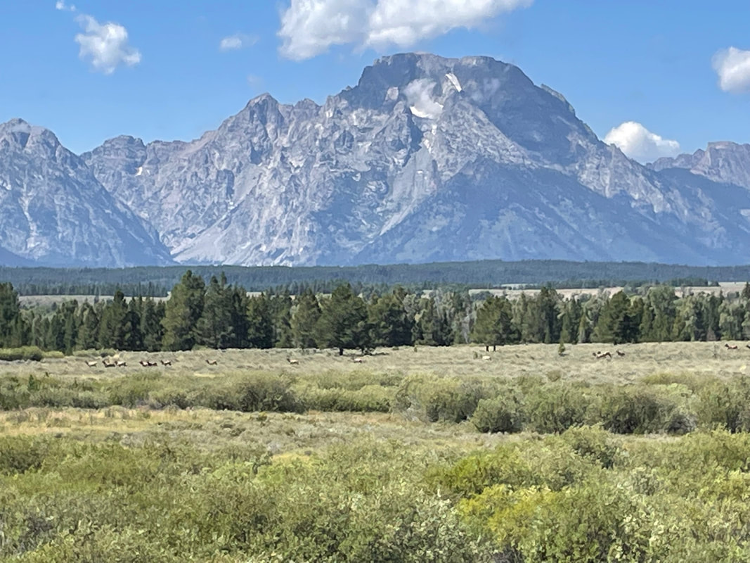
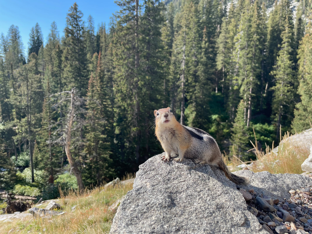
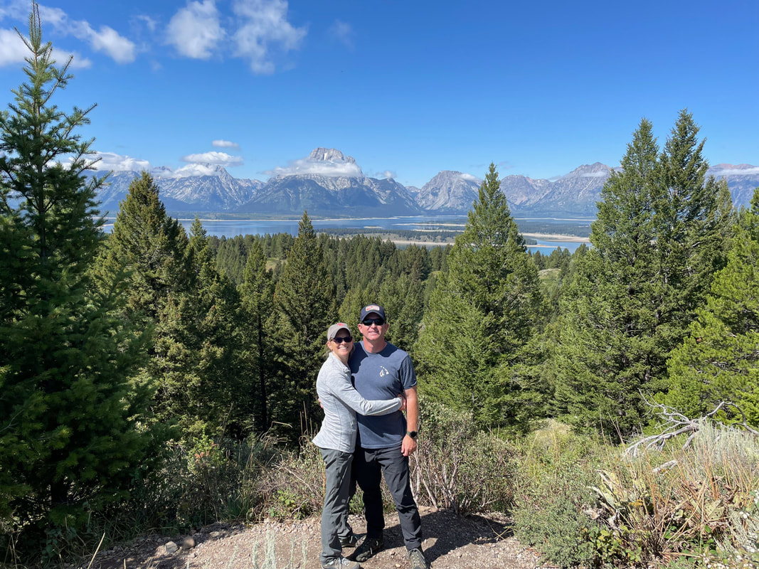
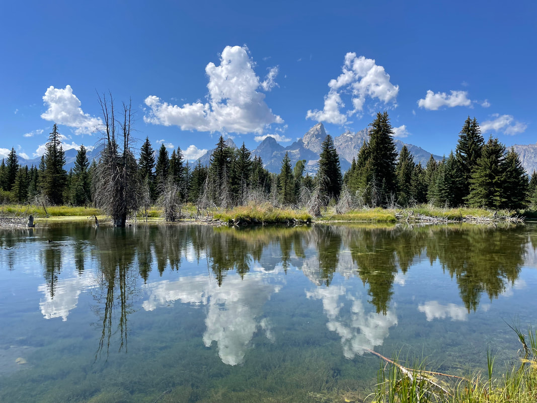
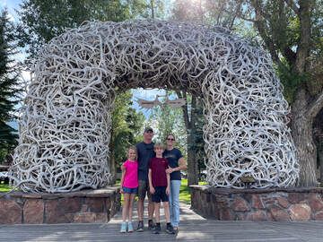
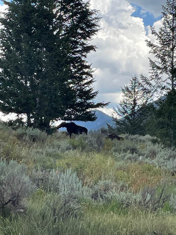
 RSS Feed
